
Valley fog forms when cold-air drainage and temperature inversion trap cool air below — classic radiation fog in mountain valleys for UPSC.
(Editorial Team)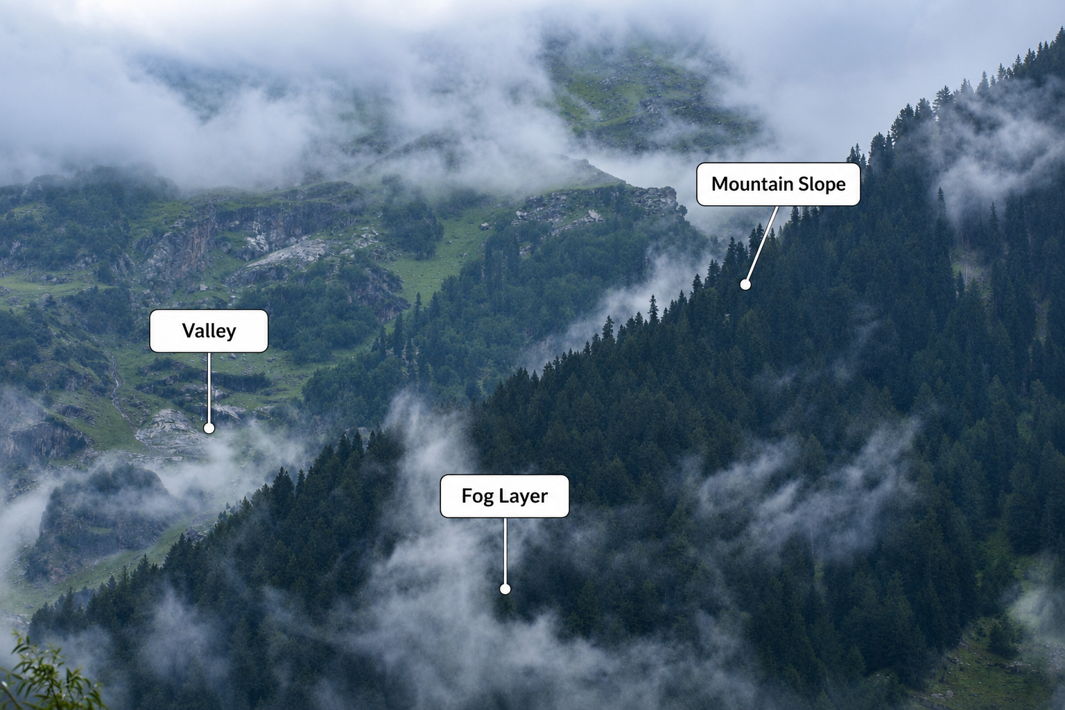
UPSCYatra’s editorial team researches and publishes syllabus guides, exam trends, previous years' questions analysis, and conceptual deep-dives for serious UPSC aspirants.
Valid till Mains 2027
If you have visited a hill station, you have probably seen this: why is the fog trapped inside the valley?
You are up in the mountains. The sun is already shining on the hilltops. The peaks look clear and bright. But down in the valley, there is a thick white blanket of fog just sitting there. It does not blow away. It does not float up to the peaks. It just stays stuck at the bottom.
So what is actually going on? Why does the fog get trapped inside the valley?
The answer is simpler than it looks. It comes down to one thing: cold air is heavy. Heavy things sink to the bottom.
That is really the whole secret. Everything else is just that one idea playing out. Cold air slides downhill at night. It pools in the lowest spot. It turns into mist. A bit like how your bathroom mirror fogs up after a hot shower.
Let's walk through it step by step.
In one line
Valley fog forms when cold, dense air drains downhill at night, pools under a temperature inversion, and turns into mist — while clearer slopes and ridges stay above the trapped cold layer.
is just mist that forms in the low ground between hills. Think of it as a cloud sitting at your feet instead of up in the sky.
You will notice a few things every time you see it:
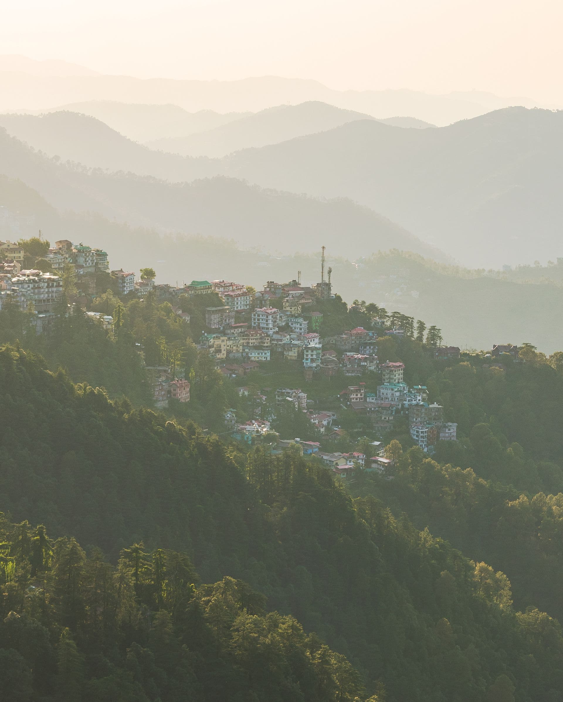
In India, you will spot it on winter mornings in places like the Kashmir Valley, Kullu–Manali, the Darjeeling foothills, and the Brahmaputra floodplain in Assam. Basically anywhere the land dips low and the night sky is clear.
And this is not the same as the sea fog that rolls in from the coast. Valley fog is made right there on the spot. The valley itself creates it.
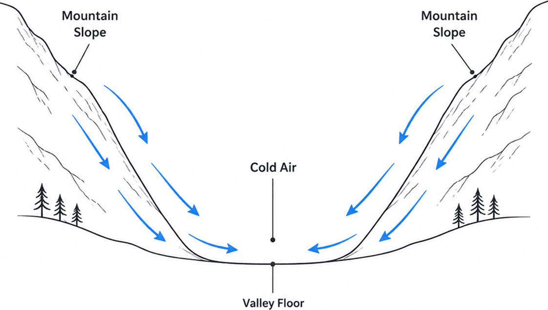
Think of cold air the same way you think about water. It is heavier than warm air. So it always slides down to the lowest place it can reach.
Here is how it happens. During the day, the ground soaks up the sun and stays warm. At night, especially when the sky is clear, the ground cools down fast. There are no clouds to act like a blanket and trap the heat. The heat escapes into the sky. The air sitting right on top of the ground cools down too.
The moment that air gets cold, it gets heavy. Gravity pulls it downhill. It starts rolling down the slopes, like a marble rolling off a tilted table. All that cold, heavy air slides down and collects at the bottom of the valley.
Three things make this even stronger:
By morning, the floor of the valley is often the coldest spot for miles around.
Scientists call the ground losing its heat to a clear sky , and the cold air sliding downhill , but you do not need the words to picture it. It is just heavy air rolling downhill on its own.
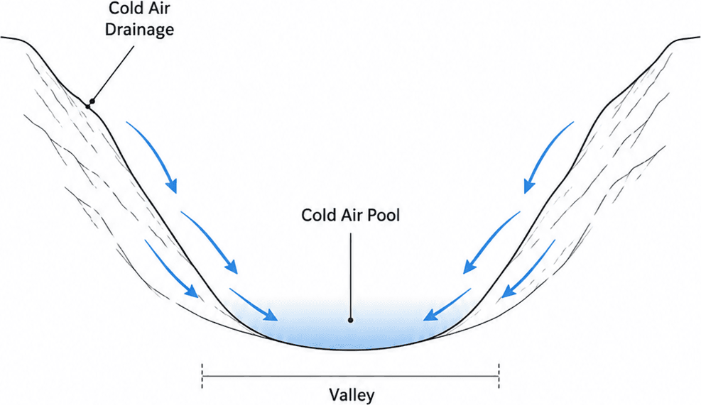
That downhill slide of cold air has a name: . Picture it as a slow, invisible river of heavy air running from the ridges down toward the centre of the valley.
Here is the sequence, one step at a time:
Steep valley walls make it happen even faster. A narrow, V-shaped valley funnels everything straight to the bottom. That is why the fog often looks like a lake slowly filling up from the sides: little wisps creeping along the side gullies until the whole floor turns white.
It is the same reason a farmer worries about frost in a low field, while a vineyard on the hillside a short walk away stays perfectly clear. The cold literally drains into the dip.
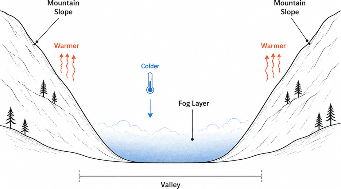
A valley is not just a path for cold air to slide down. It is a trap.
The shape of the land does the trapping. Slopes on both sides block the cold air from escaping. It behaves just like water. It fills the lowest space it can find. It cannot easily spill over a ridge unless the wind is strong enough to stir it all up.
Warm air sits on top like a lid. As cold air pools at the bottom, something interesting happens. The valley floor becomes colder than the air a little higher up. That warm air floating above acts like a lid pressing down. It stops the fog from mixing and clearing away. So the mist just stays put. This upside-down setup, warm air sitting over cold air, is called a .
The moisture has to come from somewhere. Valleys usually have rivers, wetlands, watered fields, or damp soil. That water evaporates into the cold air. Without that moisture, you would just get a cold pocket of air and no visible fog. There would be nothing to turn into droplets.
Put it all together and you get a shallow lake of cold, damp air sitting in the valley, waiting for the sun to come back.
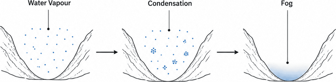
Fog is simply a cloud at ground level: the very same tiny water droplets, just low enough for you to walk through.
The trigger is temperature. Air always carries invisible water vapour in it. Cool that air down enough and it cannot hold all that water anymore. The vapour turns into tiny liquid droplets. You have felt this exact thing when your bathroom mirror fogs up after a hot shower. Warm, damp air hits a cold surface and water seems to appear out of nowhere.
The temperature where the air gets so cold the vapour starts turning into water is called the . The change from vapour to droplets is .
On a calm night in a valley, even a small drop of two or three degrees can be enough to flip that invisible moisture into visible mist.
A quick note on the different words people use:
And in the coldest valleys, the droplets can freeze into tiny ice crystals before they even hit the ground. That is the eerie, glittering freezing fog you sometimes see on high winter mornings in Ladakh or Kashmir.
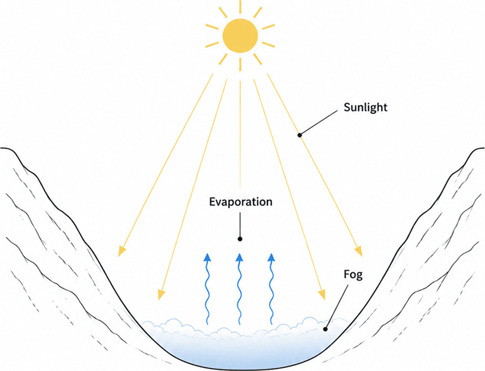
Valley fog rarely lasts past mid-morning. Once the sun is up, the whole thing runs in reverse.
The ground warms up first. The air just above it heats up too. It becomes lighter and starts to rise and mix around. That warm lid we talked about breaks apart. As the air warms and dries a little, the fog droplets evaporate back into invisible vapour. Gentle warm breezes creep up the sunlit valley walls. They help drag the last of the mist upward and scatter it. That upward warm breeze is the opposite of the night-time downhill flow. It is called .
The clearing is uneven, though. The slopes facing the sun warm up first. So the fog usually peels away from those sides earliest. Shaded ravines tucked under cliffs or forest hold onto their wisps until late morning.
So the next time you watch it happen, you are really watching a daily rhythm. Cold air draining down at night. Warm air drawing it back up by day.
Both fog and cloud are made of the exact same stuff: tiny water droplets or ice crystals. The difference is not what they are made of. It is where and how they form.
Valley fog forms down at the surface. Air already sitting in the valley cools in place or drains into the low ground. It is a local thing, tied to the shape of the land. It is mostly a night-to-morning story.
A cloud on a peak is made a different way. Here, moist air gets pushed upward by the mountain. It is forced to rise, cool down, and turn into cloud. That forced lifting of air over a mountain is called . Those cap-like clouds you see sitting on a summit while the valley below is clear are made by air being shoved up, not by cold air pooling at the bottom.
So on the very same morning, you might look up at a cloud forming on a ridge and down at fog filling the valley floor. Same substance, two completely different stories. One is air sliding down and chilling. The other is air being pushed up and chilling.
Rain shows up in other landforms too. The same moisture that condenses into valley fog can turn slightly acidic underground and slowly hollow out limestone caves — see why caves form inside limestone.
Temperature inversion is when air gets warmer with height instead of cooler. In a valley at night, cold air pools at the bottom under a warmer layer aloft, acting like a lid that traps mist, frost, and sometimes pollution near the floor.
Radiation fog forms on clear, calm nights when the ground loses heat quickly, cools the air above it to the dew point, and moisture condenses into mist. Valley fog is often this process plus cold-air drainage into the lowest ground.
Cold, dense air slides downhill at night through katabatic flow and collects in the lowest ground. As the valley floor cools further, moisture condenses into visible fog. The bowl-shaped land and a temperature inversion trap that mist at the bottom.
Cold air is heavier than warm air, so it drains to the valley floor like water filling a bowl. The lowest spots become the coldest and dampest, which is where the thickest fog forms.
Both are made of water droplets, but valley fog forms when cold air pools and cools at the surface. A cloud on a peak forms when moist air is forced upward by the mountain through orographic lift and cools as it rises.
Sunlight warms the ground and the air above it. The temperature inversion breaks, fog droplets evaporate, and gentle upslope breezes called anabatic winds help lift and scatter the remaining mist.