
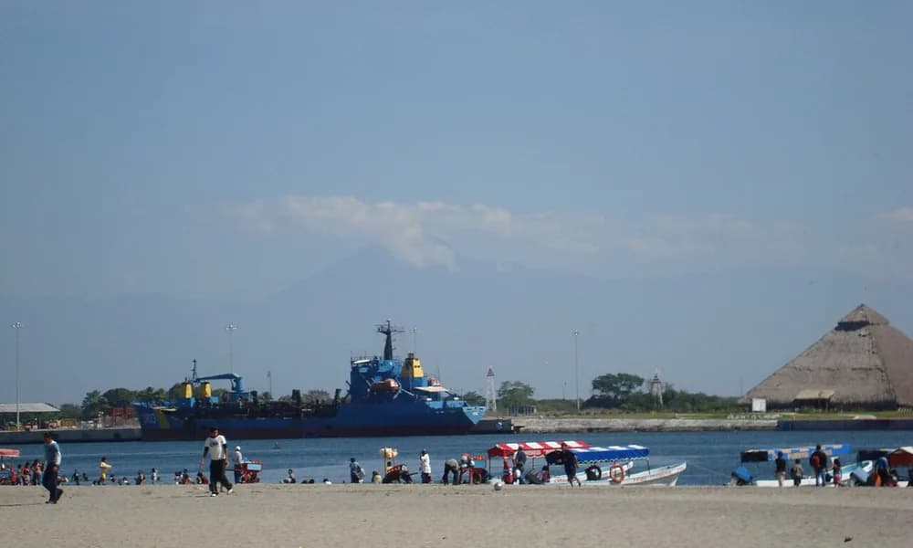
A shallow M7.3 earthquake struck offshore Puerto Madero, Chiapas, on 17 July 2026. The United States Geological Survey and the Pacific Tsunami Warning Center placed the rupture on the Middle America Trench, where the Cocos Plate dives beneath North America. Pacific tsunami warnings went out within minutes. Observed waves at Puerto Madero were about 0.3 m. No fatalities were reported. For UPSC, the event is a clean megathrust case and a depth-and-distance lesson: a large offshore quake can trigger a regional alert without producing a destructive tsunami.
Key highlights
- Date and magnitude: 17 July 2026 — USGS M7.3, offshore Chiapas, Mexico.
- Location: Near Puerto Madero on the Pacific coast; coordinates about 14.72° N, 92.90° W.
- Mechanism: Megathrust on the Middle America Trench — Cocos Plate subducting beneath North America.
- Depth: Shallow (USGS about 15 km; other agencies reported roughly 10–25 km).
- Tsunami: Warnings for Mexico and Guatemala; recorded waves about 0.3 m at Puerto Madero (PTWC 0.32 m).
- Casualties: No fatalities. Minor injuries and coastal evacuations were reported.
- Exam hook: Warning issued, waves modest — lock depth, distance from shore, and rupture type, not magnitude alone.
Where did the Chiapas earthquake strike?
The epicentre sat in the Pacific off southern Mexico, west of the fishing and port town of Puerto Madero (also linked in local usage to Puerto Chiapas). Chiapas is Mexico’s southernmost state, bordering Guatemala. The rupture was close enough for strong shaking in coastal Chiapas and neighbouring Guatemala, and far enough offshore that the seafloor displacement did not pile a large wave onto the nearest towns.
Place the event on a mental map of the eastern Pacific. North of this stretch, the smaller Rivera Plate interacts with Mexico’s west coast. South-east, the same trench continues along Guatemala, El Salvador, and Nicaragua. The July shock belongs to the Mexican–Central American segment of the Pacific Ring of Fire, not to the Caribbean transform margin that produced the Venezuela earthquake doublet a month earlier.
| Fact | Detail |
|---|---|
| Date | 17 July 2026 (about 14:49 UTC / 08:49 local) |
| Magnitude | M7.3 (USGS; early local bulletins used 7.4) |
| Depth | Shallow — USGS about 15 km |
| Epicentre | Offshore Puerto Madero, Chiapas |
| Coordinates (approx.) | 14.72° N, 92.90° W |
| Plates | Cocos beneath North America |
| Boundary / trench | Middle America Trench (megathrust) |
| Deaths | None reported |
| Tsunami | Warnings issued; ~0.3 m at Puerto Madero |
| Felt | Southern Mexico, Guatemala, El Salvador |
Aspirants should keep state (Chiapas), nearest town (Puerto Madero), and trench name as a triple. Prelims items on foreign earthquakes usually ask the plate pair or the trench, not the local street damage.
What happened on 17 July 2026
The shock was felt in the late morning along Mexico’s south coast. The Pacific Tsunami Warning Center issued a threat message for coasts of Mexico and Guatemala, with a lower forecast (waves below 0.3 m) for several other Pacific American countries. Tide gauges then recorded the actual water: 0.32 m at Puerto Madero and about 0.33 m at the Chiapas gauge. A deep-ocean DART buoy recorded only a centimetre-scale signal. By 17:00 UTC the Centre said the tsunami threat had passed.
That sequence is the teaching point. A warning is a forecast based on magnitude, depth, and location. A recorded height is an observation. The two numbers are allowed to differ. Coastal authorities in Chiapas and Guatemala still evacuated low-lying stretches; schools closed in parts of San Marcos, Quetzaltenango, Suchitepéquez, and Retalhuleu in Guatemala. Mexico’s Chiapas government suspended some administrative work. Wire reports spoke of a handful of injuries and damaged houses, not of a mass-casualty disaster. Use no fatalities as the exam figure.
An M6.4 aftershock followed about half an hour later, farther offshore. Aftershocks are expected on a megathrust interface; they do not automatically mean a second mainshock is coming.
Tectonics: Cocos under North America
Southern Mexico is not a strike-slip coast. It is a convergent margin. The Cocos Plate — a relatively small oceanic plate in the eastern Pacific — moves north-east and subducts beneath the North American Plate along the Middle America Trench. The descending slab is cold oceanic lithosphere. Friction on the plate interface stores elastic strain. When that interface slips in a large patch, the result is a megathrust earthquake.
“Megathrust” here means the main subduction contact, not a magic magnitude. An M7.3 event on that contact is large. It is not in the M8–M9 class of the 2011 Tōhoku or 2004 Sumatra ruptures. The same margin has produced both kinds. The 8 September 2017 Tehuantepec earthquake (M8.2) was a different mechanism: a normal-fault rupture inside the subducting Cocos slab, not a classic interface megathrust. That 2017 shock caused severe damage in Oaxaca and Chiapas and a local tsunami. Do not collapse 2017 and 2026 into one story. 2026 is the textbook interface case; 2017 is the intraslab trap.
Mexico’s seismic geography has a second trap. The 1985 Mexico City disaster (M8.0, Michoacán) killed thousands far from the epicentre because lake-bed sediments under the capital amplified shaking. The 2026 Chiapas rupture was farther south-east and did not reproduce that basin effect. A question that says “the 2026 Chiapas quake devastated Mexico City” is false.
North of the Cocos–North America contact, the Rivera Plate subducts beneath Jalisco and Colima. South-east, the Cocos slab also interacts with the Caribbean Plate under Central America. Chiapas sits near that triple complexity, which is why Mexican seismologists often list five plates in the regional picture: Pacific, Rivera, Cocos, North America, and Caribbean. For a Prelims line, the pair that matters for this event is Cocos–North America along the Middle America Trench.
The trench itself is a bathymetric deep off Mexico and Central America. It is the eastern-Pacific analogue of the Japan Trench or the Sunda Trench: an oceanic plate going down, a volcanic arc inland (the Trans-Mexican Volcanic Belt and Central American volcanoes), and a history of coastal earthquakes. The Sanriku earthquake of April 2026 is the Japan Trench cousin — same class of margin, different ocean.
Why the tsunami warning produced only modest waves
A tsunami is a series of long waves generated when the seafloor (or a coastal landslide) suddenly displaces a large volume of water. Three conditions raise the odds of a dangerous wave:
- Large magnitude — enough slip over a wide enough patch.
- Shallow depth — the displacement reaches the seafloor rather than being absorbed at depth.
- Vertical seafloor motion — thrust or normal slip lifts or drops the ocean bottom. Pure strike-slip slides rock sideways and is a poor tsunami maker.
The Chiapas event met the first two in a limited way: M7.3 and shallow. It was a thrust, so some vertical motion was expected. What it did not do was move a huge, near-shore patch of seafloor by several metres. Distance from the nearest gauge, the finite size of the rupture, and the way slip was distributed all kept the water signal in the decimetre range. PTWC’s forecast of 0.3–1 m for Mexico and Guatemala was therefore in the right order of magnitude; the upper end did not arrive.
This is the same logic, inverted, that makes the Mindanao M7.8 of 8 June 2026 a regional tsunami story. That rupture was larger, sat on the Cotabato Trench, and produced warnings from the southern Philippines to Indonesia, Malaysia, Palau, Japan, Taiwan, and Papua New Guinea. Chiapas shows the other half of the syllabus: alert ≠ catastrophe. The Sanriku shock in April made the same point on the Japan Trench — warnings, real but modest waves, no fatalities.
Do not write that “tsunami warnings were a false alarm.” Waves were recorded. They were small. A warning that over-predicts height is still a correct decision when the alternative is an unpredicted inundation. UPSC has asked the physics, not the press-conference tone.
How this margin usually fails
The Middle America Trench generates frequent moderate-to-large earthquakes because the Cocos slab is young and the convergence rate is high (several centimetres a year). Historical Chiapas and Tehuantepec events include large shocks in 1970, 1993, 2012, and the 2017 intraslab giant. Central America has its own deadly list (1976 Guatemala, 2001 El Salvador, 2012 Nicaragua). The 2026 rupture fits the statistical expectation: a coastal M7-class megathrust, a short-lived tsunami bulletin, limited structural damage relative to the magnitude.
Building performance still matters. Soft soils, informal housing, and hillside slopes can turn a “modest” M7.3 into local collapses even when the national death toll is zero. Guatemala reported landslides and school closures. That is disaster geography, not a contradiction of “no fatalities.”
Compare three 2026 Americas–Pacific cases in one table and the plate story becomes unforgettable:
| Event | Date | Magnitude | Mechanism | Tsunami | Deaths (locked) |
|---|---|---|---|---|---|
| Mindanao | 8 June | M7.8 | Megathrust, Sunda–Philippine Sea | Regional warnings | ≥37 |
| Venezuela | 24 June | M7.2 then M7.5 | Strike-slip doublet | Negligible | ≥6,300 |
| Chiapas | 17 July | M7.3 | Cocos–North America megathrust | ~0.3 m | None |
Magnitude does not rank deaths. Depth, distance to cities, building stock, and whether the rupture is under a capital or under open water do.
Why this matters for UPSC
World geography in Prelims rewards a place + plate + process triple. Chiapas supplies all three.
Prelims. Expect a map or match-the-following: Middle America Trench — Cocos Plate — Mexico/Central America. A common trap pairs this event with the Caribbean Plate because Guatemala is nearby. The Caribbean Plate is the right story for Venezuela, not for offshore Chiapas. Another trap treats every Mexican disaster as “Mexico City soft-soil amplification.” That is 1985, not 2026.
GS-1 (geography). Use the event to define megathrust, trench, and volcanic arc as a linked set. One short paragraph can contrast this convergent margin with the Caribbean–South American transform boundary and with the India–Eurasia collision that produces the Hindu Kush intermediate-depth shocks felt in north India.
GS-3 (disaster management). The useful argument is sequential. First, tsunami warning systems err on the side of evacuation when an offshore M7+ occurs. Second, recorded wave height depends on slip, depth, and coastal geometry. Third, a zero-fatality M7.3 is still a drill: ports, fishing fleets, and cross-border coordination (Mexico–Guatemala) are the operational layer that UPSC can ask in a case-study sentence.
Current affairs stacking. Treat mid-2026 as an earthquake season: Mindanao in June, Venezuela in June, Chiapas in July, plus the April Sanriku and Hindu Kush cards on the Places in News timeline. One comparison table beats four isolated notes.
Facts that are easy to mix up
M7.3 versus M7.4. Mexico’s Servicio Sismológico Nacional initially listed 7.4. USGS and PTWC settled on 7.3. In an answer, use M7.3 and, if space allows, note that early local magnitude can differ.
Megathrust versus 2017 Tehuantepec. The 2017 M8.2 event was a normal-fault rupture in the Cocos slab. The 2026 event is an interface megathrust. Same region, different mechanism.
Tsunami warning versus “no tsunami.” Waves of about 0.3 m were measured. That is a tsunami, just not a destructive one. Writing “no tsunami” is inaccurate.
Puerto Madero versus Mexico City. The nearest named place is a Chiapas port. The capital is more than 700 km away and was not the disaster theatre.
Cocos versus Caribbean. Cocos is the Pacific oceanic plate going down at the Middle America Trench. The Caribbean Plate slides past South America along Venezuela’s north coast. Do not swap them.
Ring of Fire as a single fault. It is a belt of many trenches and transforms. Chiapas is one address on that belt, not a synonym for every 2026 Pacific quake.
How tsunami alerts work on this coast
When a large earthquake occurs under or near the Pacific, two clocks start. The first is seismic: USGS, SSN, and other networks publish magnitude and depth within minutes. The second is oceanographic: PTWC and national centres run forecast models and watch tide gauges. A “hazardous waves possible” bulletin is not a claim that a 10-metre wall is coming. It is a statement that the source parameters justify evacuation of the immediate coast until gauges prove otherwise.
On 17 July the gauges spoke quickly. Puerto Madero is close to the epicentre, so the first peak arrived within about an hour of origin time. Once several stations showed decimetre water and the DART record stayed tiny, the threat message could be cancelled. That is how a well-instrumented ocean is supposed to behave. The Indian Ocean after 2004 built a similar chain; the Pacific has had one longer. A Mains line on “early warning systems” can use Chiapas as a successful stand-down, and Mindanao as a multi-country warning, without turning either into a coaching slogan.
Mexico’s civil-protection practice also includes school drills and coastal sirens in some states. Those systems matter more than a single magnitude number. An M7.3 under a poorly built hillside town can kill; the same magnitude under water, with a functioning alert, may not.
Prelims snapshot
| Question type | Answer to lock |
|---|---|
| Date | 17 July 2026 |
| Magnitude | M7.3 |
| Country / state | Mexico / Chiapas |
| Nearest place | Puerto Madero (offshore) |
| Trench | Middle America Trench |
| Plates | Cocos subducting under North America |
| Type | Megathrust (convergent) |
| Deaths | None |
| Tsunami height | About 0.3 m at Puerto Madero |
| Exam contrast | Warning issued; waves modest — depth and distance |
Frequently asked questions
What was the Chiapas Mexico earthquake of 2026?
It was a shallow M7.3 megathrust earthquake on 17 July 2026, offshore Puerto Madero in Chiapas. It occurred where the Cocos Plate subducts beneath North America along the Middle America Trench. Tsunami warnings were issued; recorded waves were about 0.3 m. There were no fatalities.
Why did the earthquake trigger a tsunami warning if waves were only 0.3 m?
Warnings are issued from magnitude, depth, and offshore location before tide gauges report actual heights. An M7.3 shallow thrust under the Pacific meets the threshold for a coastal alert. The rupture did not displace enough near-shore water to build a large wave, so the observed height stayed near 0.3 m and the threat was cancelled the same afternoon.
Which plates caused the Chiapas earthquake?
The Cocos Plate (oceanic, eastern Pacific) is being forced beneath the North American Plate. The contact is the Middle America Trench. This is a convergent, megathrust setting — not the Caribbean–South American strike-slip boundary of the Venezuela doublet.
Did the 2026 Chiapas earthquake cause a deadly tsunami?
No. Gauges at Puerto Madero and Chiapas recorded about 0.3 m. That is enough to justify a warning and a harbour watch, not a basin-wide disaster. No deaths were reported from shaking or from the sea.
How is this different from the 2017 Tehuantepec earthquake?
The 2017 M8.2 shock was a normal-fault, intraslab rupture inside the descending Cocos Plate. The 2026 M7.3 shock is best read as an interface megathrust on the trench. Same neighbourhood, different fault type — a frequent Prelims trap.
How should this be compared with the Mindanao and Venezuela quakes of 2026?
Mindanao was a larger megathrust (M7.8) with regional tsunami warnings and at least 37 killed. Venezuela was a strike-slip doublet (M7.2 then M7.5) that killed at least 6,300 and was not a subduction megathrust. Chiapas sits with Mindanao on mechanism and with Sanriku on the “warning, modest waves, no deaths” outcome.
What should UPSC aspirants remember about the Chiapas earthquake?
Date (17 July 2026), M7.3, Chiapas / Puerto Madero, Cocos under North America, Middle America Trench, megathrust, tsunami warning, ~0.3 m waves, no fatalities, and the depth-and-distance lesson.
Sources
- USGS / ANSS — M7.3 offshore Chiapas, 17 July 2026
- Pacific Tsunami Warning Center — 17 July 2026 threat messages and gauge heights
- List of earthquakes in 2026
- Places in News timeline
- Related explainers: Venezuela earthquake 2026, Mindanao earthquake 2026, Japan Sanriku earthquake 2026, Hindu Kush earthquake felt in India