
On 20 April 2026 at 16:53 JST (07:53 UTC), a moment magnitude 7.4 earthquake ruptured offshore the Sanriku coast of Iwate Prefecture, northeastern Honshu. The United States Geological Survey (USGS) placed the event about 100 km east-northeast of Miyako on the Japan Trench. Contemporaneous USGS/IRIS solutions listed a hypocentral depth of 35 km; later catalog rows can read nearer 25 km. Both are shallow interface depths, not a deep-slab event. It is the same convergent margin that produced the 2011 Tōhoku megathrust earthquake — the Pacific plate sliding beneath the Okhotsk / North American plate. This was a large but finite thrust rupture, not a repeat of 2011. No fatalities were reported. A local tsunami reached about 80 cm at Kuji, Iwate. Ten people were injured.
Key highlights
- Date and time: 20 April 2026, 16:53 JST / 07:53 UTC.
- Magnitude: USGS Mww 7.4 (depth 35 km); JMA later Mj 7.7; GCMT Mw 7.5.
- Place: Offshore Iwate (Sanriku), Japan Trench; ~100 km ENE of Miyako.
- Mechanism: Thrust faulting on the Pacific–Okhotsk/North American interface.
- Casualties: No fatalities; 10 injuries.
- Tsunami: Peak about 80 cm at Kuji Port; warnings later downgraded and lifted the same evening.
- Exam hook: Same trench as 2011 Tōhoku, different scale — a model convergent-boundary case, not a 2011 recap.
- USGS catalog: M 7.4 — 100 km ENE of Miyako, Japan.
Where is the Sanriku coast?
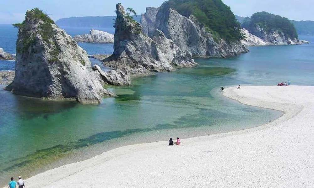
Sanriku is the Pacific shoreline of northeastern Honshu — mainly Iwate, with adjoining stretches of Aomori and Miyagi. The name is geographic, not a prefecture. Ria coasts, fishing ports (Miyako, Kamaishi, Kuji, Ōtsuchi), and a steep drop into the Japan Trench sit within a few hundred kilometres of one another. That geometry is why an offshore thrust here can shake the Tōhoku hinterland and still generate a tsunami warning even when the wave that arrives is well under a metre.
The USGS hypocentre is near 39.95° N, 143.05° E. The Places in News card uses a rounded Sanriku-offshore pin at 39.5° N, 143.8° E — same trench segment, map-scale location rather than the final catalog point. Either pair is enough for a Prelims map question: east of Iwate, on the Japan Trench, not inland under Sendai or Tokyo.
| Fact | Detail |
|---|---|
| Date | 20 April 2026 |
| Origin time | 07:53 UTC / 16:53 JST |
| USGS magnitude / depth | Mww 7.4 / ~25–35 km (catalog solutions; IRIS/COMET listed 35 km) |
| JMA magnitude | Mj 7.7 (updated from a preliminary 7.5) |
| USGS location | ~100 km ENE of Miyako, Iwate |
| Approximate coordinates | 39.5° N, 143.8° E (card); 39.95° N, 143.05° E (USGS) |
| Fault / margin | Japan Trench; thrust |
| Overriding plate | Okhotsk microplate (often mapped as North American) |
| Subducting plate | Pacific Plate |
| Casualties | No deaths; 10 injured |
| Peak tsunami | ~80 cm at Kuji, Iwate |
| Max JMA intensity | 5-upper (5+) at Hashikami, Aomori |
Keep Iwate / Sanriku / Japan Trench as a single cluster. A trap option that moves the epicentre to the Nankai Trough (southwest Japan) or the Itoigawa–Shizuoka Tectonic Line is wrong.
What is the Japan Trench?
The Japan Trench is the deep-sea trench east of Honshu where the Pacific Plate subducts westward. Convergence across this boundary is about 8–9 cm per year. The downgoing slab is old, cold, and dense; the interface can store elastic strain for decades and then fail in thrust earthquakes. That is a textbook convergent / destructive plate boundary.
Two naming conventions appear in atlases. Older maps treat northeastern Honshu as sitting on the North American Plate. Many modern reconstructions assign the overriding lithosphere to the Okhotsk (Okhotsk Sea) microplate, with the North American Plate farther east and north. UPSCYatra’s event note follows the cautious form used in the timeline card: Pacific plate subducting beneath the Okhotsk / North American plate. In an answer, either label is acceptable if you also name the Japan Trench and the Pacific Plate.
The trench is not the Nankai Trough. Nankai, south of Honshu and Shikoku, is where the Philippine Sea Plate subducts beneath southwest Japan and is the source of the anticipated Nankai megathrust sequence. Sanriku 2026 is a Pacific-plate event. Mixing the two margins is one of the most common map errors in earthquake current affairs.
A Wadati–Benioff zone of intermediate- and deep-focus earthquakes traces the Pacific slab as it sinks under Honshu and Hokkaido. The 20 April rupture itself was shallow (35 km) — on or near the plate interface, not a deep-slab event like the Sabah, Malaysia, earthquake of 2026 (~629 km) or the Tonga earthquake of 2026 (~230 km).
What the 20 April rupture actually did
USGS described an east-northeast-dipping, southwest–northeast-striking thrust. A finite-fault model estimated a rupture area of about 70 km × 65 km, with maximum slip near 4.7 m close to the hypocentre and a source duration of roughly 12 seconds. That is a compact M7-class interface earthquake: large enough for a tsunami warning, far smaller than a trench-wide megathrust.
Shaking was felt from Hokkaido to Aichi. JMA intensity reached 5-upper in Hashikami, Aomori. Long-period ground motion of class 3 was reported in southern Akita and northern Miyagi — the sort of motion that sways high-rises more than it topples wooden houses. Peak ground acceleration of 0.404 g was recorded at Morioka, Iwate.
A foreshock sequence had been underway since November 2025, including several M6-class events (strongest Mw 6.8). After 20 April, aftershocks included an Mw 5.6 the same day. Those numbers belong in a current-affairs note; they do not turn 2026 into 2011.
JMA issued a tsunami warning for waves up to 3 m along parts of Iwate, Aomori, and Hokkaido, then stepped it down to advisories and lifted all alerts at 23:50 JST. Observed heights were much smaller than the warning ceiling: about 80 cm at Kuji, 40 cm at Miyako and at Urakawa (Hokkaido), and about 30 cm at Hiroo, Erimo, and Sendai. NOAA’s tsunami research group, using the USGS origin, recorded a first detection at the Miyako tide gauge about 17 minutes after origin time. This is the exam point: a warning is a forecast envelope, not a measurement. The Chiapas, Mexico, earthquake of 2026 showed the same pattern on another trench — Pacific tsunami messages, modest observed waves.
Impact stayed in the injury-and-damage band. Ten people were injured (two in Hokkaido, four each in Aomori and Iwate); two injuries were serious. Hundreds of buildings were damaged, mainly in Aomori. Evacuation orders covered tens of thousands of households along the Pacific coast. Some Shinkansen services and the Aomori–Hakodate ferry were suspended. Roughly 200 households lost power in Hiraizumi, Iwate. None of that is a fatality count. Treat “no fatalities” as the locked casualty fact unless a later official revision appears.
Same margin as 2011 — not the same earthquake
The useful comparison is margin, not magnitude.
On 11 March 2011, an Mw 9.0 megathrust ruptured a much longer stretch of the Japan Trench interface, displaced the seafloor over a wide area, and drove a tsunami that devastated the Sanriku rias and sent a nuclear accident at Fukushima Daiichi into the global record. Moment magnitude is logarithmic in amplitude and scales with seismic moment. An M9 releases on the order of 250 times the energy of an M7.4 if you use the standard 1.5-times-magnitude energy relation. The 2026 event lasted about 12 seconds; 2011’s main rupture lasted minutes and involved slip of tens of metres on a trench-parallel fault hundreds of kilometres long.
So the correct sentence for a Mains introduction is: Sanriku 2026 ruptured the Japan Trench, the same Pacific–Okhotsk/North American boundary as the 2011 Tōhoku earthquake, but as a compact M7.4 thrust with a local tsunami under one metre and no deaths. The incorrect sentence is any version that treats 2026 as “another 2011” or spends the paragraph retelling Fukushima.
Historical Sanriku earthquakes are a separate list. The 869 Jōgan event, the 1896 Meiji-Sanriku tsunami earthquake, and the 1933 Sanriku outer-rise normal-fault earthquake all sit on or seaward of this trench. 1933 is the reminder that not every Sanriku disaster is an interface thrust: some break the incoming Pacific plate. USGS classified 20 April 2026 as thrust, which points back to the megathrust interface, not an outer-rise normal fault.
JMA and the Cabinet Office issued a subsequent-earthquake advisory (後発地震注意情報) through 27 April, stating that the chance of a magnitude-8-class event on this margin was elevated for a week (they quoted a rise from a background 0.1% to about 1%). That is a Japanese operational product, not a prediction that a megaquake would occur. A June Mw 6.9 offshore Iwate event is a later, smaller shock on the same coast; do not merge it with 20 April in a one-line current-affairs note.
Why this matters for UPSC
Physical geography in Prelims rewards a place + plate + mechanism triad. Sanriku 2026 supplies all three.
Prelims. Expect a map or matching item: Sanriku / Iwate — Japan Trench — Pacific Plate — thrust. Distractors will be Nankai Trough, Philippine Sea Plate, Mid-Atlantic Ridge, or “transform fault.” Also expect a statement pair on tsunami warnings versus observed wave height, and a depth question that contrasts this 35 km interface shock with the deep-focus Sabah event and the intermediate-depth Hindu Kush (Jorm) earthquake.
GS-1 (geography). A short paragraph can use 2026 to illustrate: (a) ocean–continent/ocean–microplate convergence; (b) why trench geometry plus shallow thrust equals tsunami potential; (c) why magnitude and rupture length, not the trench name alone, decide disaster scale.
GS-3 (disaster management). Japan’s seconds-scale JMA warning, coastal evacuation of more than 170,000 people, and same-day cancellation of the tsunami alert are a working example of end-to-end warning. India’s coastal system (INCOIS) is the domestic parallel, but do not invent a claim that INCOIS issued a bulletin for this event unless you have the circular.
Current affairs stacking. April 2026 was a Pacific-margin month: North Maluku M7.4 on 1 April, then Sanriku on 20 April. March had already seen the Tonga M7.5. One revision table of 2026 trench events beats five isolated clippings.
This explainer sits on the Places in News timeline as japan-sanriku-eq-2026.
Facts that are easy to mix up
M7.4 versus Mj 7.7. USGS moment magnitude and JMA’s magnitude are different scales. Quote USGS M7.4 as the international catalog value; mention JMA 7.7 if the question is about Japanese reporting.
Sanriku versus Tōhoku versus Iwate. Tōhoku is the region. Iwate is the prefecture nearest the epicentre. Sanriku is the coastal stretch. The earthquake is not “the Tokyo earthquake.”
Japan Trench versus Nankai Trough versus Ryukyu Trench. Pacific Plate → Japan Trench. Philippine Sea Plate → Nankai and Ryukyu. The Mindanao earthquake of 2026 is a Philippine Sea / Sunda story, not a Japan Trench story.
No fatalities versus “several killed.” Early social posts and some secondary round-ups inflated deaths. Official impact reporting used in the public record for this event is injuries, not deaths. Stick to no fatalities.
Tsunami warning versus 80 cm wave. A 3 m warning that verifies at 80 cm is not a failed warning. It is a conservative coastal call on an M7.4 offshore thrust.
2011 comparison versus 2011 recap. Same trench, different seismic moment. Do not write the Fukushima timeline into a 2026 note.
Okhotsk versus North American. Both names refer to the overriding plate in NE Japan. Do not invent a third plate (Eurasian) as the slab that is subducting here — the slab is Pacific.
Depth, tsunami, and the 2026 comparison set
Shallow offshore thrust + vertical seafloor motion is the tsunami recipe. Sanriku 2026 had the first two ingredients at modest scale. The Tonga earthquake was stronger (M7.5) but much deeper (~230 km), which is why a large Pacific-trench magnitude did not automatically mean a Sanriku-style coastal wave. The Sabah earthquake was M7.1 at ~629 km — deep-focus, little surface damage, no tsunami story. The Hindu Kush Jorm earthquake was only M5.8 but killed 12 because buildings and depth-felt-area interacted differently. Magnitude without depth is an incomplete answer.
Eastern Indonesia’s North Maluku M7.4 on 1 April is the closest 2026 twin in magnitude and depth (also ~35 km), but it sits at a triple junction (Philippine Sea, Pacific, Sunda), not on the Japan Trench. Use the pair to show that M7.4 is a size, not a setting.
Prelims snapshot
| Question type | Answer to lock |
|---|---|
| Date | 20 April 2026 |
| USGS magnitude / depth | M7.4 / shallow (~25–35 km) |
| Coast / prefecture | Sanriku / Iwate (Tōhoku) |
| Trench | Japan Trench |
| Subducting plate | Pacific Plate |
| Overriding plate | Okhotsk / North American |
| Mechanism | Thrust (megathrust interface) |
| Fatalities | None |
| Peak observed tsunami | ~80 cm (Kuji) |
| 2011 link | Same margin; not the same rupture scale |
| Not to confuse with | Nankai Trough; 2011 Tōhoku megathrust |
Frequently asked questions
When and where was the Japan Sanriku earthquake of 2026?
It struck at 16:53 JST (07:53 UTC) on 20 April 2026, offshore the Sanriku coast of Iwate, about 100 km east-northeast of Miyako on the Japan Trench.
What was the magnitude of the 2026 Sanriku earthquake?
The USGS moment magnitude is Mww 7.4 at 35 km depth. JMA’s Japanese magnitude was updated to 7.7. GCMT published Mw 7.5. For international comparison, use USGS 7.4.
Was the Sanriku earthquake on the same fault as the 2011 Tōhoku earthquake?
It was on the same plate boundary — the Japan Trench, where the Pacific Plate subducts beneath the Okhotsk / North American plate. It was not a rerun of the 2011 Mw 9.0 rupture. The 2026 source was a much smaller thrust patch with a short duration and a local tsunami under one metre.
Did the 2026 Japan earthquake cause a tsunami?
Yes. JMA warned for waves up to 3 m, then cancelled alerts the same night. The largest measured tsunami was about 80 cm at Kuji, Iwate. Other gauges recorded 30–40 cm.
Were there fatalities in the 2026 Sanriku earthquake?
No fatalities were reported. Ten people were injured, and there was building, road, and transport disruption in Tōhoku and Hokkaido.
Which plates meet at the Japan Trench?
The Pacific Plate subducts westward beneath the Okhotsk microplate, which many school maps still label as the North American Plate.
What should UPSC aspirants remember about the Sanriku earthquake 2026?
Date (20 April 2026), USGS M7.4 at 35 km, offshore Iwate / Sanriku, Japan Trench, Pacific under Okhotsk/North American, thrust, no deaths, ~80 cm tsunami at Kuji, same margin as 2011 but not an M9 repeat. Contrast depth with Sabah (deep-focus) and Hindu Kush (intermediate-depth).
Sources
- USGS — M 7.4, 100 km ENE of Miyako, Japan (us6000sri7)
- NOAA Center for Tsunami Research — 20 April 2026 Miyako tsunami
- Japan Meteorological Agency earthquake and tsunami bulletins, 20 April 2026
- Places in News timeline
- Related explainers: Hindu Kush earthquake felt in India, North Maluku earthquake 2026, Tonga earthquake 2026, Sabah Malaysia earthquake 2026