
A M7.1 earthquake struck offshore Sabah, Malaysia, on 22 February 2026. The hypocentre was about 629 km down. That single number is the whole lesson. At more than 300 km, the shock is a deep-focus earthquake. It produced little surface damage. Magnitude 7.1 would be a disaster if it ruptured under a city at 10 km. At 629 km it is a geophysics demonstration: the slab is still brittle that far into the mantle, and the surface barely notices.
Key highlights
- Date: 22 February 2026.
- Magnitude: M7.1.
- Location: Offshore Sabah, northern Borneo, Malaysia.
- Depth: about 629 km — deep-focus (deeper than 300 km).
- Surface effect: little damage; not a tsunami event.
- Exam hook: textbook contrast with shallow, damaging quakes; Wadati–Benioff zone teaching case.
- Pair with: Hindu Kush earthquake felt in India (intermediate) and Mindanao earthquake 2026 (shallow thrust).
Where is Sabah?
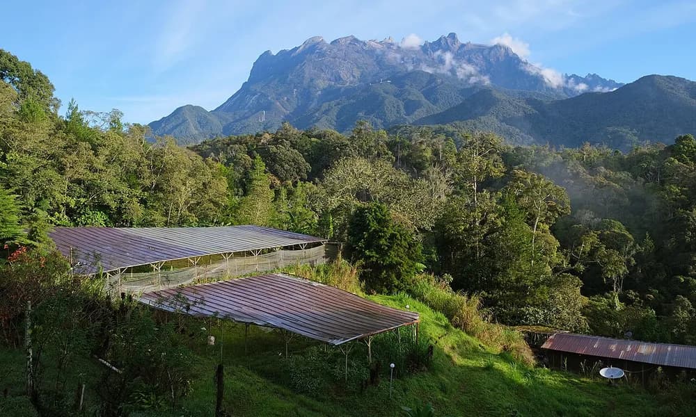
Sabah is the Malaysian state on the northern tip of Borneo. To the west is the South China Sea; to the east, the Sulu and Celebes seas. Kota Kinabalu is the state capital. Mount Kinabalu, the highest peak in Malaysia, sits inland — a useful map name, not the epicentre of this shock. The February 2026 event was offshore, in the seas north of the state.
Malaysia is not usually the first country students list when they think of great earthquakes. Peninsular Malaysia sits on the relatively stable Sunda Plate interior. Sabah is different. Northern Borneo lies closer to the complex plate boundary between the Sunda Plate and the Philippine Sea Plate, with slabs descending at the Philippine and related trenches. Deep earthquakes under this region are uncommon in the news cycle, which is why a M7.1 at 629 km is worth a dedicated note.
| Fact | Detail |
|---|---|
| Date | 22 February 2026 |
| Magnitude | M7.1 |
| Depth | about 629 km |
| Depth class | Deep-focus (greater than 300 km) |
| Place | Offshore Sabah, Borneo, Malaysia |
| Coordinates (approx.) | 6° N, 118.5° E |
| Surface damage | Little |
| Tsunami | Not a tsunami-generating event |
| Why UPSC cares | Clean deep-focus example; depth versus damage |
Coordinates in the event record are longitude 118.5, latitude 6. Write 6° N, 118.5° E. Do not place the pin in Peninsular Malaysia or in Indonesian Kalimantan without checking the map.
What “deep-focus” actually means
Standard seismology splits earthquakes by hypocentre depth. The labels are not journalism. They are exam vocabulary.
| Class | Depth | Typical setting | What the surface feels |
|---|---|---|---|
| Shallow | 0–70 km | Crust and plate interface | Strong local shaking; buildings fail; tsunami possible if the seafloor moves |
| Intermediate | 70–300 km | Mid-slab, Wadati–Benioff zone | Wide-area felt reports; damage possible but usually less than a shallow quake of the same magnitude |
| Deep-focus | greater than 300 km | Lower slab, transition-zone depths | Often little damage; no tsunami; felt as a long, gentle roll if felt at all |
Deep-focus is the term for events below about 300 km. Do not use it for every “deep” news headline. The Tonga earthquake 2026 at about 230 km is intermediate. The Hindu Kush earthquake felt in India at about 188 km is also intermediate. Sabah at about 629 km is the 2026 event that actually crosses the deep-focus line — and by a wide margin.
Why can a fault slip that far down? A cold oceanic slab stays brittle longer than the surrounding mantle. As it sinks, it still produces earthquakes along a dipping plane. That plane is the Wadati–Benioff zone. Deep-focus earthquakes are almost always intraslab events: they happen inside the descending plate, not on the shallow megathrust where the two plates first meet.
Two consequences follow. First, the source is hundreds of kilometres from cities and from the seafloor. Intensity dies away. Second, the seafloor does not lurch, so a tsunami is not generated. A M7.1 deep-focus shock and a M7.1 shallow megathrust are not the same kind of disaster. They share a magnitude number and almost nothing else.
The Wadati–Benioff zone as a teaching case
Kiyoo Wadati in Japan and Hugo Benioff in the United States independently mapped the dipping sheets of earthquakes beneath trenches. The zone is the geometric proof of subduction: hypocentres get deeper as you move from the trench toward the overriding plate. Shallow events sit near the trench. Intermediate events sit mid-slab. Deep-focus events sit at the lower end, sometimes deeper than 600 km, before the slab is absorbed into the mantle.
Sabah’s M7.1 is useful because the depth is unambiguous. Nobody can argue that 629 km is “almost intermediate.” It is a lower-slab event. In a Mains diagram, you would draw: trench → shallow interface → volcanic arc → intermediate slab earthquakes → deep-focus tail. This shock belongs on the last segment.
The plate geometry around Borneo is messier than Tonga’s clean westward Pacific descent. Multiple trenches and rotated microplates meet between the Philippines, Sulawesi, and northern Borneo. You do not need the full name of every microplate for Prelims. You need this: deep-focus earthquakes occur in subducting slabs; 629 km under the Sabah offshore is a slab event; little surface damage is the expected outcome, not a surprise.
Contrast with damaging shallow earthquakes
The exam use of Sabah is contrast. Keep a four-row table in your notes.
| Event | Magnitude | Depth class | Human / tsunami outcome |
|---|---|---|---|
| Sabah, 22 February 2026 | M7.1 | Deep-focus (~629 km) | Little surface damage; no tsunami |
| Pacitan, Java, 6 February 2026 | M5.8 | Shallow thrust, Sunda megathrust | One death; same zone as the 1994 and 2006 tsunamigenic quakes |
| Hindu Kush, 3 April 2026 | M5.8 | Intermediate (~188 km) | Felt in northern India; fatalities in the source region |
| Mindanao, 8 June 2026 | M7.8 | Shallow thrust | Tsunami warnings across the region; dozens killed |
Read the table left to right. Sabah has a larger magnitude than Pacitan or the Hindu Kush event and still does less harm. Mindanao has a similar “major” magnitude class to Sabah and a completely different outcome because it is shallow and on an interface. If you remember only one sentence: depth determines surface impact more reliably than a one-point difference in magnitude.
A second contrast is local and historical, not from the 2026 set. Sabah’s 2015 Ranau earthquake was a shallow inland shock near Mount Kinabalu. It was smaller in magnitude than 2026 and far more destructive on the mountain because hikers and rock faces sat in the near field. Do not treat “Sabah earthquake” as one species. 2015 was crustal. 2026 is deep-focus. Same state, opposite syllabus point.
Why little surface damage is the expected result
Seismic intensity is not magnitude. Magnitude measures energy at the source. Intensity measures shaking at a place. Waves from 629 km travel through a huge volume of mantle and crust. They arrive spread out in time and weakened in high-frequency content — the frequencies that break unreinforced houses. People over a wide area may feel a long sway. Chimneys and glass are more at risk than collapse. That is “little surface damage” as a physical prediction, not as luck.
The same physics kills the tsunami hypothesis. A tsunami needs a sudden vertical shove of the ocean floor. A slip 629 km down does not shove the ocean floor. Coastal advisories, if any, are precaution. They are not evidence that a wave was generated.
For GS-3, this is the pair to the 2004 Indian Ocean tsunami. 2004 was a shallow megathrust on the Sunda margin. Sabah 2026 is a deep-focus slab event near Borneo. Both involve subduction. Only one type moves the sea.
Malaysia, Borneo, and map traps
Prelims likes to test whether you know Sabah from Sarawak, and Malaysian Borneo from Indonesian Kalimantan. Sabah is the north-eastern Malaysian state. Sarawak is the larger south-western Malaysian state on the same island. Brunei sits on the north coast between them. Kalimantan is the Indonesian remainder of Borneo. This earthquake is labelled offshore Sabah, Malaysia. A statement that places it in Sumatra or in Peninsular Malaysia is false.
Mount Kinabalu is a UNESCO World Heritage site and a frequent environment/geography name. It is the right mountain for a Sabah map question. It is the wrong hypocentre for February 2026. The 2026 source is offshore and hundreds of kilometres down.
Tectonically, do not write that “Malaysia has no earthquakes.” Peninsular Malaysia is low-seismicity compared with Sumatra, but it feels distant events, and Sabah has a documented shallow history plus this deep-focus case. Precision beats a slogan.
Why this matters for UPSC
Prelims. The phrase deep focus earthquake UPSC almost always means: define the 300 km cutoff, name a Wadati–Benioff setting, and contrast damage with shallow events. Sabah 2026 is a dated, numbered example you can drop into a one-liner. Also expect: “All magnitude-7 earthquakes cause severe destruction.” False. “Deep-focus earthquakes occur in the crust.” False. “Deep-focus earthquakes are typical of mid-ocean ridges.” False — ridges are shallow and extensional.
GS-1. Use Sabah to explain why earthquake belts follow trenches and why hypocentres deepen inland from the trench. The Wadati–Benioff zone is the diagram; this event is the deep end of the diagram.
GS-3. Disaster management: building codes and tsunami SOP are designed for shallow sources. A deep-focus M7.1 is a reminder to read depth in the first line of any bulletin before predicting casualties.
India link. India does not sit on this slab. The India-relevant deep-to-intermediate story is the Hindu Kush, where an intermediate earthquake is routinely felt in northern India because of the India–Eurasia collision. Use Hindu Kush for “felt in Delhi.” Use Sabah for “what deep-focus means.” Do not merge the two into one vague “deep Asian earthquake.”
This explainer sits on the Places in News timeline with the rest of the 2026 geography set.
Facts that are easy to mix up
Deep-focus versus “deep.” Journalists call 80 km deep. The syllabus does not. Below 70 km is already past shallow. Below 300 km is deep-focus. Sabah qualifies. Tonga (230 km) and Hindu Kush (188 km) do not.
629 km versus 230 km. Both are “far down” in ordinary speech. Only 629 km is deep-focus. If you have room for one number, keep 629.
Sabah versus Sumatra. Sumatra is the classic Indian-ocean megathrust (2004). Sabah is northern Borneo. Different margin, different depth class for this event.
Little damage versus “no earthquake.” People can still feel a deep-focus M7.1. The point is limited damage, not invisibility.
Kinabalu 2015 versus Sabah 2026. 2015: shallow, mountain, deaths. 2026: offshore, 629 km, little surface damage. Same state label, opposite mechanism.
How to write a 30-second Mains insert
Earthquakes are classified by depth as shallow (0–70 km), intermediate (70–300 km), and deep-focus (greater than 300 km). Deep-focus events occur inside a cold subducting slab along the Wadati–Benioff zone. The 22 February 2026 M7.1 earthquake offshore Sabah, Malaysia, at about 629 km is a clean example: high magnitude, little surface damage, no tsunami. By contrast, a smaller shallow thrust on the Sunda margin (Pacitan, M5.8) can kill, and a shallow M7.8 off Mindanao can trigger regional tsunami warnings. Depth, not the magnitude integer alone, governs surface impact.
Prelims snapshot
| Question type | Answer to lock |
|---|---|
| Date | 22 February 2026 |
| Magnitude | M7.1 |
| Depth | about 629 km |
| Class | Deep-focus (greater than 300 km) |
| Place | Offshore Sabah, Malaysian Borneo |
| Damage | Little at the surface |
| Zone concept | Wadati–Benioff (intraslab) |
| Contrast event (intermediate) | Hindu Kush, about 188 km |
| Contrast event (shallow, tsunami warnings) | Mindanao M7.8 |
| Keyword | deep focus earthquake UPSC |
Frequently asked questions
What was the Sabah Malaysia earthquake of 2026?
A M7.1 earthquake on 22 February 2026, offshore Sabah, at about 629 km depth. It was a deep-focus event and caused little surface damage.
What is a deep-focus earthquake?
An earthquake whose hypocentre is deeper than about 300 km. Such events occur inside a subducting slab (the Wadati–Benioff zone). They can be strong and still do little damage at the surface. They do not generate tsunamis.
How is deep-focus different from intermediate and shallow?
Shallow: 0–70 km — crust and plate interface; damaging; tsunami possible. Intermediate: 70–300 km — mid-slab; the Tonga and Hindu Kush 2026 events sit here. Deep-focus: greater than 300 km — this Sabah shock.
Why was there little damage despite magnitude 7.1?
The source was about 629 km down. Waves spread and weaken before they reach towns. High-frequency shaking that collapses buildings is reduced. The seafloor does not move, so there is no tsunami.
Is Sabah on the Pacific Ring of Fire?
Northern Borneo sits near the complex boundary between the Sunda and Philippine Sea plates, in the broader western Pacific subduction realm. The useful exam sentence is intraslab / Wadati–Benioff, not a slogan about the entire Ring of Fire.
What should UPSC aspirants remember?
M7.1, 22 February 2026, ~629 km, deep-focus, offshore Sabah, little surface damage. Define the 300 km cutoff. Contrast with Hindu Kush (intermediate, felt in India) and Mindanao (shallow, tsunami warnings).
Can a deep-focus earthquake be felt in India?
This Sabah event is not the India-felt case. For tremors in northern India from a distant intermediate source, use the Hindu Kush. Deep-focus and “felt in Delhi” are different notes.
Sources
- Event parameters as recorded on the Places in News timeline (USGS-linked compilation): M7.1, 22 February 2026, about 629 km, little surface damage
- USGS Earthquake Hazards Program — depth classification
- Related explainers: Tonga earthquake 2026, Pacitan Java earthquake 2026, Hindu Kush earthquake felt in India, Mindanao earthquake 2026