
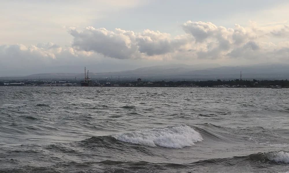
An M7.8 thrust-fault earthquake struck offshore Sarangani, southern Mindanao, on 8 June 2026 (07:37 Philippine time). It was the Philippines’ strongest earthquake since 1990. PHIVOLCS tied the rupture to subduction on the Cotabato Trench, at the convergent boundary between the Sunda Plate and the Philippine Sea Plate. Tsunami warnings covered the southern Philippines and reached Indonesia, Malaysia, Palau, Japan, Taiwan, and Papua New Guinea. At least 37 people were killed. For UPSC this is the flagship 2026 megathrust-and-tsunami case — the opposite mechanism from the Venezuela strike-slip doublet later the same month.
Key highlights
- Date and magnitude: 8 June 2026 — M7.8 (USGS / PHIVOLCS after revision from an initial 7.0).
- Location: Offshore Sarangani, southern Mindanao; coordinates about 5.7° N, 124.7° E.
- Mechanism: Thrust / megathrust on the Cotabato Trench (and the nearby Sangihe junction).
- Plates: Sunda Plate and Philippine Sea Plate (convergent).
- Depth: USGS about 57 km; PHIVOLCS 33 km — both intermediate-shallow, not Hindu Kush-deep.
- Tsunami: Warnings across the southern Philippines, Indonesia, Malaysia, Palau, Japan, Taiwan, and PNG.
- Deaths: At least 37 killed.
- Exam hook: Largest Philippine shock since 1990; shows how an offshore megathrust generates a regional alert even when the death toll is far below a Caribbean urban doublet.
Where did the Mindanao earthquake strike?
The epicentre was in the Celebes Sea / Moro Gulf approaches off Maasim and Glan in Sarangani province, near the southern tip of Mindanao. General Santos — the main city of the Soccsksargen coast — sat in the severe-shaking field. Davao Occidental and South Cotabato were the other hard-hit provinces. Across a narrow sea, the Sangihe and Talaud islands of North Sulawesi, Indonesia, also shook.
Mindanao is the large southern island of the Philippines. It does not sit on a single straight trench. West and south-west, oceanic crust of the Sunda Plate (Celebes Sea) goes down at the Cotabato Trench. East of the archipelago, the Philippine Sea Plate interacts with the Philippine Mobile Belt along the Philippine Trench. Strike-slip motion is taken up by the Philippine Fault and the Cotabato Fault system on land. The 8 June shock belongs to the trench, not to the on-land strike-slip family.
| Fact | Detail |
|---|---|
| Date | 8 June 2026 (07:37 PhST; 23:37 UTC on 7 June) |
| Magnitude | M7.8 |
| Depth | USGS ~57 km; PHIVOLCS 33 km |
| Epicentre | Offshore Sarangani (near Maasim / Kablalan) |
| Coordinates (approx.) | 5.7° N, 124.7° E |
| Fault / trench | Cotabato Trench (thrust) |
| Plates | Sunda – Philippine Sea |
| Type | Megathrust / thrust-fault |
| Deaths | ≥ 37 |
| Tsunami | Regional warnings; local run-up reported up to a few metres on some coasts |
| Superlative | Strongest in the Philippines since 1990 |
Keep Sarangani, Cotabato Trench, and M7.8 as the three-word card. A trap that moves the epicentre to Manila or to the Luzon Strait is guessing from “Philippines” alone.
What happened on 8 June 2026
PHIVOLCS first posted M7.0, then raised the event to M7.8 as waveforms came in. USGS and EMSC agreed on M7.8. Shaking lasted on the order of a minute. Intensity reached PEIS VIII (very destructive) in parts of Sarangani and MMI IX in the USGS model for a small coastal patch. General Santos recorded destructive intensities; a high-rise in Davao City was filmed swaying. Landslides cut roads in Glan and Jose Abad Santos. Parts of the southern coastline were uplifted, exposing reef flats — a field signature of thrust slip.
Tsunami procedures started immediately. PHIVOLCS ordered coastal evacuation in Sarangani, Davao Occidental, Tawi-Tawi, Sulu, Basilan, Zamboanga del Sur, Zamboanga Sibugay, Sultan Kudarat, and South Cotabato. Indonesia’s BMKG warned parts of Sulawesi, the Maluku Islands, Gorontalo, and the Sangihe chain. Malaysia posted advisories for Sabah beaches (Tawau, Semporna, Kunak, Lahad Datu). The Pacific Tsunami Warning Center added Palau, Taiwan, Papua New Guinea, and a Pacific-coast watch for Japan. That list is the exam sentence: an offshore megathrust in the southern Philippines is a multi-state warning problem, not a single-bay story.
Waves were real. Philippine coastal surveys later recorded run-up of about 2.5 m at Lebak, Sultan Kudarat, and metre-scale water at several Sarangani and Sultan Kudarat sites. Indonesian gauges stayed mostly in the decimetre-to-metre range. Japan and Palau saw centimetre-to-decimetre signals. Some people drowned or were swept off the General Santos waterfront. The death toll still came chiefly from collapse and landslides, not from a 1976-style basin-wide inundation.
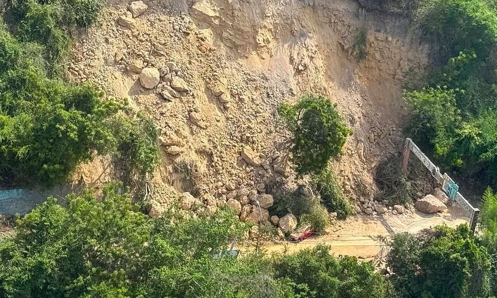
At least 37 people were killed — the figure locked for this explainer and for the Places in News record. Later operational tallies rose as municipalities finished counts; use at least 37 in answers unless a question paper cites a newer official total. Thousands of homes were damaged in Sarangani, General Santos, and Davao Occidental. General Santos airport closed for inspection. Power plants on the south coast tripped. Aftershocks ran into the thousands, including M6.5-class events.
Tectonics: Sunda, Philippine Sea, and the Cotabato Trench
Mindanao sits where two plates converge obliquely. The Philippine Sea Plate moves west-north-west relative to Eurasia / Sunda. Part of that motion is taken up by subduction; part by strike-slip on the Philippine Fault. South-west of Mindanao, the Cotabato Trench is the surface expression of east-dipping (or locally complex) subduction of Celebes Sea lithosphere — crust belonging to the Sunda Plate — beneath the Philippine Mobile Belt.
The Cotabato Trench is the southern member of a west-Philippine trench family that also includes the Manila Trench and the Negros Trench. It is a relatively young subduction zone (late Miocene to Pliocene). At its northern end, convergence can reach the order of 100 mm/year. That is fast. Fast convergence plus a locked interface is how megathrusts are built.
The 8 June hypocentre sat near the junction where the north-west-trending Cotabato Trench meets the more north–south Sangihe Trench. Focal mechanisms were thrust: one block of crust pushed up over another. Whether the rupture used the southern Cotabato interface, the northern Sangihe interface, or both is a research detail. The exam-level statement is enough: convergent boundary, thrust, megathrust-class, offshore Mindanao.
This is not the Venezuela story. The 24 June doublet was right-lateral strike-slip on the Caribbean–South American boundary. No trench, no regional Pacific-style tsunami, enormous urban deaths. Mindanao is the trench page of the same month.
It is also not the Hindu Kush page. Hindu Kush earthquakes are intermediate-depth (often 150–200 km) inside a collision zone and are routinely felt in north India. Mindanao at 33–57 km is a subduction-interface / upper-slab depth, not a deep-Hindu-Kush depth.
A useful third contrast is the Chiapas M7.3 of 17 July: also a megathrust (Cocos–North America, Middle America Trench), also a tsunami warning, but only ~0.3 m waves and no fatalities. Same class of fault, smaller rupture, different ocean, different outcome. The Sanriku M7.4 of 20 April is the Japan Trench cousin — Pacific Plate under the Okhotsk / North American side, warnings, modest waves, no deaths.
Why regional tsunami warnings went out
A tsunami warning after an offshore thrust is not theatre. Three source facts justified a wide net.
Magnitude. M7.8 is in the range that can displace a large patch of seafloor. Energy scales logarithmically; this event released far more moment than a typical M6 aftershock.
Mechanism. Thrust slip has a vertical component. Water is lifted or dropped with the seafloor. Strike-slip (Venezuela) does this poorly; thrust (Mindanao, Chiapas, Sanriku) does it well.
Geography. The Celebes Sea and Moro Gulf are semi-enclosed. Energy can focus on facing coasts of Mindanao, Sulawesi, and Sabah. The Pacific Tsunami Warning Center’s basin products then add distant coasts that sit on connecting deep-water paths — hence Palau, Taiwan, and a Japanese advisory even when those places would see only small waves.
PHIVOLCS told coastal residents that waves more than one metre above normal tide were possible and that the first energy could arrive within two hours and persist. About 10,000 families evacuated in Sarangani and Sultan Kudarat. Boats in harbour were told to move; boats already in deep water were told to stay out. That SOP is the disaster-management paragraph, not a product advertisement.
The historical memory behind the urgency is the 16 August 1976 Moro Gulf earthquake — an M8-class rupture on the same trench that drove a tsunami into the Moro Gulf and killed on the order of 8,000 people. 2026 was smaller and the warning system was faster. The trench, however, is the same address. A Prelims trap is to say 2026 was “the first tsunami-generating quake on the Cotabato Trench.” It was not.
Strongest since 1990 — what that superlative means
The locked line is: strongest earthquake in the Philippines since 1990. The comparison point is the 16 July 1990 Luzon earthquake (about M7.7), which devastated Baguio and the Central Luzon plain on the Philippine Fault — a strike-slip disaster, not a trench tsunami disaster. 2026 exceeds that magnitude and sits on a different structure.
Do not write that 2026 was the deadliest Philippine earthquake on record. 1976 Moro Gulf and several older events killed more people. Do not write that it was the first M7+ in Mindanao in the twenty-first century; the island has a busy catalogue, including the 2019 Cotabato sequence and a 2023 M7.4 offshore Davao Oriental event. The 2026 superlative is magnitude since 1990, plus regional tsunami warnings.
Coastal uplift of up to about 2 m along tens of kilometres of the Sarangani–Davao Occidental shore is the field evidence students can picture: a thrust that raises the coast is the same motion that can shove a wave. Coral and boats left above the new tide line are the geography photograph; the warning list is the current-affairs photograph.
Why this matters for UPSC
Prelims. Expect plate names and the trench. Sunda Plate and Philippine Sea Plate at a convergent boundary; Cotabato Trench; thrust / megathrust; M7.8; 8 June 2026; Sarangani / Mindanao; tsunami warnings in a multi-country list; ≥37 dead; strongest since 1990. Traps: calling it strike-slip (that is Venezuela, or the Philippine Fault); placing it on the Manila Trench (that is west of Luzon); or saying India felt it (that is Hindu Kush).
GS-1. One Mains paragraph can treat the Philippines as a mobile belt caught between two oceans of subduction, then contrast (a) trench megathrusts, (b) the Philippine Fault, and (c) volcanic arcs. Mindanao 2026 is exhibit (a).
GS-3. Early warning, cross-border alerts (PHIVOLCS, BMKG, MetMalaysia, JMA, PTWC), evacuation of a first-day-of-school morning, airport closure, and landslide risk on tropical slopes are all usable. The comparison with Venezuela writes the “hazard versus vulnerability” line: a larger offshore thrust killed fewer people than a smaller urban strike-slip pair.
Map work. Pin Sarangani Bay, General Santos, the Celebes Sea, North Sulawesi, and Sabah. The Places in News timeline already holds this card beside Chiapas, Venezuela, Sanriku, and Hindu Kush.
Facts that are easy to mix up
Cotabato Trench versus Cotabato city / province. The trench is a seafloor structure off south-western Mindanao. Cotabato as a place-name also refers to inland provinces and to Cotabato City. The 2026 epicentre was offshore Sarangani, not under Cotabato City.
Sunda Plate versus Sunda Trench. The Sunda Trench (Java–Sumatra) is the megathrust that produced 2004. The Sunda Plate is the plate. Mindanao used the plate name and a different trench (Cotabato).
1990 versus 1976. 1990 = magnitude superlative (Luzon, strike-slip). 1976 = tsunami-deadliest modern precedent on this trench.
Depth. 33 km (PHIVOLCS) and 57 km (USGS) are both plausible for a subduction event. Neither is a 188 km Hindu Kush depth. Do not call Mindanao a “deep-focus” earthquake.
Death toll. Use at least 37. Later situation reports added more names as rubble and landslides were cleared. Do not overwrite the locked floor with a guess.
Japan warning versus Japan disaster. A JMA advisory for the Ryukyu / Pacific coast does not mean Tōhoku 2011 repeated. Observed Japanese water was small. The Sanriku event in April was a separate Japan Trench earthquake.
How the Philippine warning system is organised
PHIVOLCS issues earthquake parameters and a Philippine tsunami warning for domestic coasts. The Pacific Tsunami Warning Center in Hawai‘i issues basin products. Indonesia’s BMKG and Malaysia’s meteorological service cover their own shores. Japan’s JMA decides whether a distant Philippine source warrants a domestic advisory. UPSC does not need the org chart in full. It needs the idea that a southern Mindanao megathrust is automatically a Celebes Sea and west-Pacific problem.
India’s own Indian Ocean warning centre (INCOIS) is the Bay of Bengal analogue. A Mains answer on “tsunami early warning after 2004” can mention that the Pacific already had this architecture, and that 8 June 2026 is what the architecture looks like when it runs: many countries, graded wave forecasts, stand-down when gauges come in.
Prelims snapshot
| Question type | Answer to lock |
|---|---|
| Date | 8 June 2026 |
| Magnitude | M7.8 |
| Island / province | Mindanao / Sarangani |
| Trench | Cotabato Trench |
| Plates | Sunda and Philippine Sea |
| Type | Thrust / megathrust |
| Deaths | ≥ 37 |
| Superlative | Strongest in the Philippines since 1990 |
| Tsunami | Regional warnings (PH, ID, MY, Palau, JP, TW, PNG) |
| Contrast | Venezuela = strike-slip doublet, far more deaths |
Frequently asked questions
What was the 2026 Mindanao earthquake?
An M7.8 thrust earthquake on 8 June 2026 off Sarangani, southern Mindanao. PHIVOLCS attributed it to the Cotabato Trench. It was the strongest Philippine earthquake since 1990. Tsunami warnings went out across several countries. At least 37 people were killed.
Which plates are involved?
The Sunda Plate and the Philippine Sea Plate meet at a convergent boundary. Off south-western Mindanao, Celebes Sea lithosphere subducts at the Cotabato Trench. That is a megathrust setting, not a transform like northern Venezuela.
Why were tsunami warnings issued as far as Japan and Palau?
An offshore M7.8 thrust can move the seafloor enough to send a basin-scale alert. PTWC and national agencies warn any coast that models say might see a measurable wave. Most distant coasts saw only small water. The warning radius is set by source type, not by the final death toll.
How is this different from the Venezuela earthquakes of 24 June 2026?
Venezuela was a shallow strike-slip doublet (M7.2 then M7.5) on the Caribbean–South American boundary. It was not a megathrust, produced no dangerous tsunami, and killed at least 6,300. Mindanao was a larger trench thrust with regional tsunami warnings and at least 37 dead.
Was this the same trench as the 1976 Moro Gulf disaster?
Yes — the Cotabato Trench. 1976 was larger in tsunami impact and deaths. 2026 is the modern warning-system counterpart on the same margin. Do not confuse that precedent with the 1990 Luzon strike-slip earthquake, which is the magnitude-superlative comparison.
Did India feel the Mindanao earthquake?
No meaningful felt reports in India belong to this event. The 2026 shock that Indian cities noticed was the deep Hindu Kush (Jorm) earthquake. Different plate setting, different depth, different syllabus line.
What should UPSC aspirants remember?
8 June 2026, M7.8, Sarangani / Mindanao, Cotabato Trench, Sunda–Philippine Sea, megathrust, regional tsunami warnings, ≥37 dead, strongest since 1990, and the June contrast with Venezuela’s strike-slip doublet.
Sources
- 2026 Mindanao earthquake
- USGS / PHIVOLCS parameters as reported in the event record (M7.8; depths 57 km / 33 km)
- Places in News timeline
- Related explainers: Venezuela earthquake 2026, Chiapas Mexico earthquake 2026, Japan Sanriku earthquake 2026, Hindu Kush earthquake felt in India