
On 1 April 2026 at 22:48 UTC — 2 April local morning in eastern Indonesia — a moment magnitude 7.4 earthquake ruptured the Molucca Sea between North Sulawesi and North Maluku. The USGS placed the hypocentre about 126 km west-northwest of Ternate at a depth of 35 km. Indonesia’s BMKG published Mw 7.3. One person was killed, several people were injured, and more than 450 structures were damaged or destroyed, most of them on the Batang Dua islands. A small tsunami was recorded; the highest reported coastal reading was about 75 cm in North Minahasa.
Eastern Indonesia is not a single trench like the Japan Trench. It is a triple-junction neighbourhood where the Philippine Sea, Pacific, and Sunda plates — plus smaller pieces such as the Molucca Sea, Halmahera, and Sangihe plates — grind through double subduction and arc–arc collision. Halmahera and the volcanic island of Ternate sit on that volcanic-arc frame. That is the geography an M7.4 here is meant to teach.
Key highlights
- Origin time: 1 April 2026, 22:48 UTC (2 April, 06:48 WITA / 07:48 WIT).
- Magnitude and depth: USGS Mww 7.4 at ~35 km; BMKG Mw 7.3.
- Place: Molucca Sea, offshore North Maluku, ~126 km WNW of Ternate; near the Batang Dua islands.
- Mechanism: Reverse (thrust) faulting; rupture ~100 km × 55 km.
- Casualties: One death, four injuries; 450+ structures damaged or destroyed.
- Tsunami: Small waves; up to ~75 cm in North Minahasa; warning later lifted.
- Exam hook: Eastern Indonesia triple junction — Philippine Sea, Pacific, and Sunda plates — plus the Halmahera / Ternate volcanic arc.
- USGS catalog: M 7.4 — Molucca Sea / Ternate–Bitung (us6000slss).
Where is North Maluku?
North Maluku (Maluku Utara) is the Indonesian province around Halmahera, Ternate, Tidore, and neighbouring islands, east of Sulawesi, west of Papua, north of the Banda Sea. The Molucca Sea is the water body between the North Sulawesi (Minahasa) peninsula and Halmahera. The 2026 epicentre was in that sea, not under a volcano’s summit and not on Java’s south coast.
USGS lists 1.117° N, 126.297° E. The Places in News card uses a rounded offshore pin at 1.6° N, 126.5° E — same sea, map-scale location. Either pair answers a Prelims map item: between Sulawesi and Halmahera, just north of the equator, Indonesia.
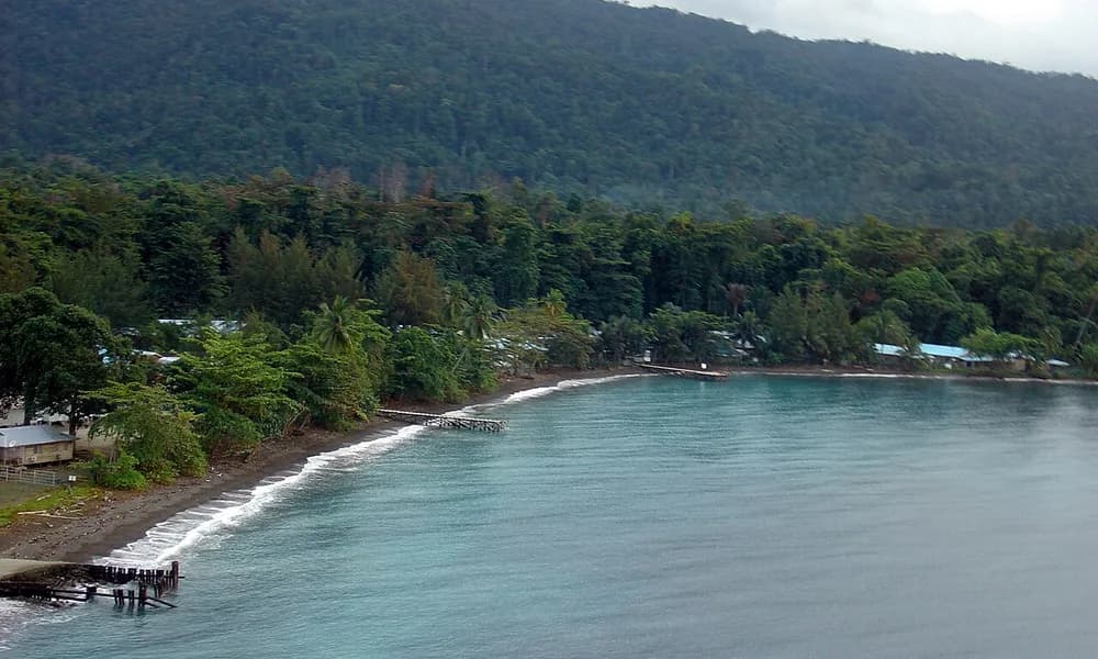
Ternate is a small volcanic island and a historic spice-sultanate city; administratively the Batang Dua islands belong to Ternate city even though they sit closer to the rupture. Halmahera is the large, K-shaped island that hosts the Halmahera volcanic arc. Bitung and Manado (North Sulawesi) are the western cities that felt strong shaking. Do not confuse North Maluku with Maluku province (Ambon / Seram) farther south, or with the Pacitan, East Java, earthquake of 2026 on the Sunda trench facing the Indian Ocean.
| Fact | Detail |
|---|---|
| USGS origin | 1 April 2026, 22:48 UTC |
| Local date | 2 April 2026 (WITA / WIT) |
| USGS magnitude / depth | Mww 7.4 / 35 km |
| BMKG magnitude | Mw 7.3 |
| Location | Molucca Sea, ~126 km WNW of Ternate |
| Card coordinates | 1.6° N, 126.5° E |
| USGS coordinates | 1.12° N, 126.30° E |
| Mechanism | Reverse / thrust |
| Duration (source) | ~30 seconds |
| Casualties | 1 death; 4 injuries |
| Damage | 450+ structures; worst on Batang Dua |
| Max intensity | MMI VIII (Severe) on Batang Dua; VI at Ternate |
| Peak tsunami | ~75 cm, North Minahasa |
| Aftershocks | 1,000+ in the following week; strongest Mwb 6.2 |
Philippine Sea, Pacific, and Sunda plates
Most school maps stop at “Indonesia = Ring of Fire.” That is true and too coarse for this event.
The Sunda Plate is the microplate under much of Southeast Asia — Sumatra, Java, Borneo, and the shallow seas to the north. Its southern and western edge is the famous Sunda Trench, where the Indo-Australian Plate subducts (the Pacitan 2026 setting). Its eastern edge is a mess of small plates and colliding arcs.
The Philippine Sea Plate lies east of the Philippines and south toward the Moluccas. It subducts or glances against neighbouring plates along the Philippine Trench, the Manila Trench, and a set of boundaries that reach toward Halmahera. The Mindanao earthquake of 2026 is a Philippine Sea / Sunda story on the other side of this neighbourhood.
The Pacific Plate is the great oceanic plate to the east. In New Guinea and the northern Moluccas it does not behave like the clean Japan Trench. It interacts with the Caroline and Philippine Sea systems and with the northern rim of the Australian/Sunda world. Eastern Indonesia is where those three large names stop being parallel trenches and start being a triple junction — a region where three plates (and several microplates) meet.
Under the Molucca Sea the textbook detail is even more specific. The Molucca Sea Plate is being consumed by double subduction: it sinks westward under the Sangihe arc (North Sulawesi side) and eastward under the Halmahera arc. That arc–arc collision is unusual. USGS notes that this tectonic region has produced more than a hundred M6+ earthquakes since the early twentieth century, including two Mw 7.7 events in 1932 and 1968. The 1 April 2026 shock is one more reverse-faulting earthquake in that collision zone, not a stray intraplate curiosity.
For an answer booklet: Eastern Indonesia’s high seismicity reflects a triple-junction setting among the Philippine Sea, Pacific, and Sunda plates, expressed locally as Molucca Sea double subduction and the Halmahera–Sangihe arc collision.
Halmahera, Ternate, and the volcanic arc
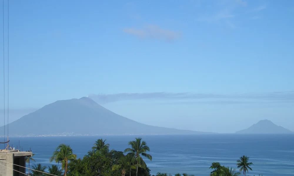
Halmahera carries an active volcanic arc. Ternate is a classic volcanic island: the stratovolcano Gamalama builds the island that the city occupies. Tidore is another volcanic edifice next door. These volcanoes exist because of the same convergence that produced the earthquake. That does not mean Gamalama erupted on 1 April. A reverse-fault earthquake in the Molucca Sea and an andesitic arc volcano share a plate setting; they are not the same event.
The exam use of the photo pair is deliberate. Halmahera is the large island of the province; Ternate is the volcanic city-island that news wires used as the geographic tag (“WNW of Ternate”). If a question asks “Ternate is a coral atoll,” the answer is no. If it asks “North Maluku 2026 was a volcanic eruption,” the answer is no.
Arc volcanism here is Ring of Fire volcanism: hydrous melting above a subducting slab, steep stratovolcanoes, frequent ash and lava histories. Contrast that with hotspot shields (Kīlauea) or mid-ocean-ridge fissures (Reykjanes). The earthquake article is not a volcano article; the arc is context for why this sea is so active.
What the rupture did
USGS described reverse faulting, moderately dipping northwest or southeast, consistent with the regional pattern. A finite-fault estimate gave a rupture about 100 km by 55 km, cutting through the Batang Dua islands, with maximum slip a little over 1 m and a source duration of about 30 seconds. That is a larger patch than the Sanriku M7.4 of 20 April (about 70 × 65 km, higher peak slip, shorter duration), on a completely different margin.
Felt intensities tell the coastal story. USGS estimated MMI VIII (Severe) on Batang Dua, VI at Ternate, V at Ibu and Manado, and III across much of Gorontalo. Aftershocks exceeded 1,300 in a week; 25 were felt; the strongest was Mwb 6.2.
The tsunami was real and small. Readings compiled after the event include about 75 cm in North Minahasa, 65 cm at Kema, and smaller signals at Beo, Talengen, and even ~5 cm at Davao, Philippines. BMKG issued and then lifted a tsunami warning. NOAA’s tsunami research page, using the USGS origin, records first detection at a North Sulawesi tide gauge about 17 minutes after origin time, with later waves in the train larger than the first — a standard warning-education point: the first wave is not always the highest.
Impact: one death (a sports-hall collapse in Manado, North Sulawesi), four injuries, a damaged hospital and several government buildings in Manado, and the heaviest housing losses on Batang Dua (more than a hundred homes collapsed; nearly 2,000 people displaced). Ternate, Bitung, Halmahera, Tidore, Minahasa, and Gorontalo reported damaged houses, churches, a school, roads, and some landslides. Use one death as the locked fatality figure. Do not import Java or Mindanao tolls into this card.
Same magnitude as Sanriku, different plate puzzle
April 2026 produced two M7.4 earthquakes at ~35 km depth: North Maluku on 1 April and Sanriku on 20 April. Side by side they teach more than either does alone.
| North Maluku, 1 April | Sanriku, 20 April | |
|---|---|---|
| Magnitude / depth | M7.4 / 35 km | M7.4 / 35 km |
| Setting | Molucca Sea collision / triple junction | Japan Trench megathrust |
| Plates | Philippine Sea, Pacific, Sunda (+ microplates) | Pacific under Okhotsk / North American |
| Deaths | 1 | 0 |
| Tsunami | Up to ~75 cm | Up to ~80 cm at Kuji |
| Arc context | Halmahera / Ternate volcanic arc | Tōhoku volcanic arc is farther west; this was a trench event |
Add two depth contrasts from the same year. The Tonga earthquake (24 March, M7.5, ~230 km) is an intermediate-depth Pacific-slab event under a classic trench. The Sabah, Malaysia, earthquake (22 February, M7.1, ~629 km) is the deep-focus contrast: large magnitude, little surface damage, source far below 300 km in a sinking slab. North Maluku is shallow, which is why Batang Dua saw MMI VIII and a local tsunami at all.
The Hindu Kush Jorm earthquake (3 April, M5.8, 188 km, 12 deaths, felt in India) is the reminder that fatalities track buildings and depth, not the M7 headline. Two days after North Maluku, a smaller intermediate-depth shock in Afghanistan had already become the year’s deadliest event to date.
Java’s Pacitan earthquake is the other Indonesian 2026 file: Sunda Trench, Indo-Australian plate under the Sunda Plate, Indian Ocean side. North Maluku is the eastern Indonesian file. One country, two margins.
Why this matters for UPSC
Prelims. Map: North Maluku / Halmahera / Ternate / Molucca Sea / equator. Plates: Philippine Sea, Pacific, Sunda — not “Indo-Australian under Java” unless the question is Pacitan. Mechanism: reverse. Depth: shallow, 35 km. Casualties: one. Tsunami: yes, small. Volcano: Ternate/Gamalama is context, not the event type.
GS-1. Triple junctions, arc–arc collision, and why the Ring of Fire is not one trench. A sentence on double subduction of the Molucca Sea Plate scores higher than “Indonesia is seismic.”
GS-3. Island and small-island exposure (Batang Dua), tsunami warning lift after modest waves, hospital and sports-hall damage in a city (Manado) that was not the epicentre. Warning plus building stock again.
Current affairs stacking. 1 April North Maluku → 3 April Hindu Kush → 20 April Sanriku is a single April 2026 revision strip, with Tonga (March) and Sabah (February) as depth end-members.
This explainer is the long form of the Places in News card north-maluku-eq-2026.
Facts that are easy to mix up
1 April versus 2 April. USGS origin time is 1 April 22:48 UTC. In North Sulawesi that is the morning of 2 April. Both dates appear in reports; they are the same earthquake.
M7.4 versus BMKG 7.3 versus local “7.6” headlines. Use USGS M7.4 as the catalog magnitude. BMKG’s Mw 7.3 is the Indonesian agency figure. Some Indonesian news used a higher local magnitude; do not treat those as USGS.
North Maluku versus Maluku versus North Sulawesi. The sea sits between North Sulawesi and North Maluku. The death was in Manado (North Sulawesi). The worst island damage was Batang Dua (North Maluku / Ternate city). The province name in the title is North Maluku; the felt region is both shores.
Ternate the volcano versus Ternate the epicentre. The epicentre was offshore, ~126 km WNW of the city. Gamalama did not “cause” the M7.4.
Triple junction versus Japan Trench. Do not recycle the Sanriku plate sentence here. Pacific-under-Okhotsk is Japan. This is eastern Indonesia’s multi-plate collision.
Sunda Trench versus Sunda Plate. The Sunda Plate is the SE Asian block. The Sunda Trench is its Indian Ocean edge. North Maluku is on the plate’s eastern entanglement, not on the Java trench.
Deep-focus. 35 km is shallow. Sabah is the deep-focus pair.
Prelims snapshot
| Question type | Answer to lock |
|---|---|
| USGS date / time | 1 April 2026, 22:48 UTC (local 2 April) |
| Magnitude / depth | M7.4 / ~35 km |
| Sea / province | Molucca Sea / North Maluku |
| Nearest city tag | ~126 km WNW of Ternate |
| Plates | Philippine Sea, Pacific, Sunda |
| Local tectonics | Molucca Sea double subduction; Halmahera–Sangihe arcs |
| Mechanism | Reverse / thrust |
| Deaths | 1 |
| Tsunami | Small; up to ~75 cm |
| Volcanic arc | Halmahera / Ternate (context, not the event) |
| Depth class | Shallow (contrast Sabah deep-focus) |
Frequently asked questions
When and where was the North Maluku earthquake of 2026?
USGS origin time is 22:48 UTC on 1 April 2026 (morning of 2 April locally). The epicentre was in the Molucca Sea about 126 km west-northwest of Ternate, between North Sulawesi and North Maluku, at about 35 km depth.
What was the magnitude of the North Maluku earthquake?
The USGS moment magnitude is Mww 7.4. BMKG reported Mw 7.3. Use 7.4 for international comparison.
Which plates caused the North Maluku earthquake?
Eastern Indonesia sits near a triple junction involving the Philippine Sea, Pacific, and Sunda plates. Locally the Molucca Sea Plate is consumed by double subduction under the Sangihe and Halmahera arcs. The 2026 shock was reverse faulting in that collision zone.
Did the earthquake cause a tsunami?
Yes, a small tsunami. The highest reported reading was about 75 cm in North Minahasa. BMKG’s warning was later lifted. This was not a basin-wide Pacific tsunami.
How many people died?
One person was killed and four were injured. More than 450 structures were damaged or destroyed, especially on the Batang Dua islands.
Is Ternate a volcano or an earthquake epicentre?
Ternate is a volcanic island (Gamalama) and the city used in the USGS place name. The hypocentre was in the Molucca Sea, not in the volcano. The Halmahera / Ternate arc explains why the region is active; it is not the rupture itself.
How should UPSC aspirants contrast this with other 2026 quakes?
Same size and depth as Sanriku, different plates. Contrast Sabah for deep-focus, Tonga for a deep Pacific-trench slab, Hindu Kush for an intermediate-depth shock felt in India, and Pacitan for Indonesia’s Sunda Trench side.
Sources
- USGS — M 7.4, Molucca Sea (us6000slss)
- NOAA Center for Tsunami Research — 1 April 2026 Ternate tsunami
- BMKG / BNPB situation reporting, April 2026
- Places in News timeline
- Related explainers: Japan Sanriku earthquake 2026, Hindu Kush earthquake felt in India, Tonga earthquake 2026, Sabah Malaysia earthquake 2026, Pacitan Java earthquake 2026