
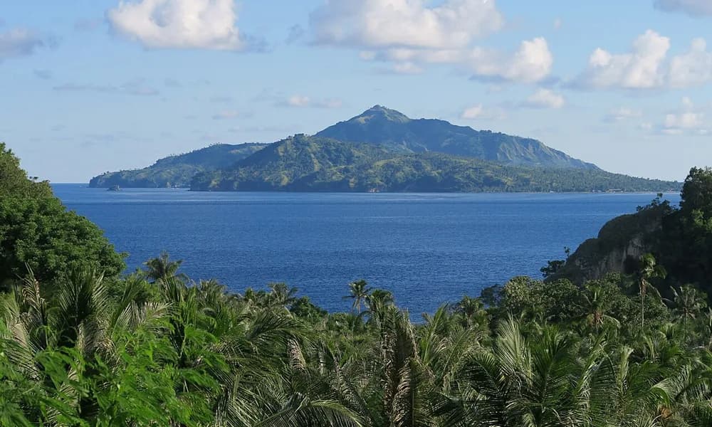
A shallow M7.8 earthquake struck off the north coast of Flores, in Indonesia’s East Nusa Tenggara province, at dawn on 15 August 2026 (05:58 local time). The rupture was on the Flores Back Arc Thrust, a fault that runs behind the volcanic island arc, not on the Sunda–Java Trench in front of it. Indonesia’s disaster agency BNPB counted 136 dead and 1,776 injured. A local tsunami reached 1.61 m at Reok in Manggarai. It was Indonesia’s deadliest earthquake since the 2022 Cianjur (West Java) quake. For UPSC, the event is the clearest 2026 example of a back-arc thrust and a direct echo of the 1992 Flores earthquake and tsunami.
Key highlights
- Date and time: 15 August 2026, 05:58 WITA (14 August, 21:58 UTC).
- Magnitude: USGS Mww 7.8; Indonesia’s BMKG Mw 7.7.
- Depth: Shallow — USGS about 10 km, BMKG about 18 km.
- Location: About 8.31° S, 121.35° E, roughly 66–68 km north-north-west of Ende, off northern Flores.
- Fault: Thrust on the Flores Back Arc Thrust, north of the volcanic arc, dipping south beneath the island.
- Toll (BNPB): 136 dead, 1,776 injured (336 seriously); about 95,567 homes damaged and about 188,000 people displaced.
- Tsunami: Maximum 1.61 m at Reok, Manggarai — far smaller than in 1992 because most of the rupture lay under land.
- Exam hook: Not every Indonesian megaquake is a trench event. Know the back-arc thrust.
Where did the Flores earthquake strike?
Flores is a long, narrow island in the Lesser Sunda Islands (Nusa Tenggara), east of Sumbawa and Komodo and west of Lembata and Alor. The Flores Sea lies to its north and the Savu Sea to its south. The epicentre sat just off the north coast, in the Flores Sea, roughly opposite the town of Ende, which lies on the island’s south coast. That geometry matters. The fault dips south, so a rupture that starts offshore in the north quickly runs under the island itself.
The worst-hit districts were in the west and centre of the island: Manggarai (capital Ruteng), East Manggarai, Nagekeo, Ngada, Ende, Sikka (capital Maumere) and West Manggarai (whose port, Labuan Bajo, is the gateway to Komodo National Park). Shaking reached MMI VIII (severe) in Manggarai. USGS issued an orange PAGER alert for economic and human losses.
| Fact | Detail |
|---|---|
| Date | 15 August 2026, 05:58 WITA (14 August, 21:58 UTC) |
| Magnitude | Mww 7.8 (USGS); Mw 7.7 (BMKG) |
| Depth | About 10 km (USGS); about 18 km (BMKG) |
| Epicentre | Off north Flores, ~66–68 km NNW of Ende |
| Coordinates (approx.) | 8.31° S, 121.35° E |
| Province | East Nusa Tenggara (Nusa Tenggara Timur), Indonesia |
| Fault | Flores Back Arc Thrust |
| Deaths | 136 (BNPB) |
| Injured | 1,776 (336 seriously) |
| Homes damaged | About 95,567 (27,414 heavily) |
| Displaced | About 188,000 |
| Tsunami | Maximum 1.61 m at Reok, Manggarai |
Lock the triple Flores + back-arc thrust + Reok tsunami. A Prelims option that puts this quake “on the Java Trench” is wrong.
What happened on 15 August 2026
The shaking came just before sunrise, when most people were still at home. That timing, plus a large stock of unreinforced masonry and timber houses on hillsides, explains why the house-damage count ran into the tens of thousands. BMKG issued a tsunami warning about 2 minutes and 16 seconds after the shock. Coastal residents on the north shore moved uphill, and the warning was lifted later that morning once the water had settled.
The sea did reach the coast. The highest measured wave was 1.61 m at Reok, a north-coast town in Manggarai. Smaller waves were recorded at Maurole in Ende district (about 0.94 m), at Labuan Bajo (about 0.3 m) and as far west as Dompu on Sumbawa. Damage, however, came mostly from ground shaking, not water.
BNPB’s tally gave 136 deaths. Manggarai (41) and East Manggarai (36) recorded the most, followed by Nagekeo (13). The rest came from Sikka, Ende, Ngada and West Manggarai, plus deaths linked to aftershocks and the response. 1,776 people were injured, 336 of them seriously. About 95,567 homes were damaged, 27,414 of them heavily, and roughly 188,000 people were displaced. Schools, health facilities, places of worship, bridges and mobile towers were also hit. The ferry and passenger terminal at Maumere collapsed. A landslide scarred a crater wall at Kelimutu National Park, famous for its three coloured crater lakes.
The government declared a 14-day state of emergency from 15 August. Navy hospital ships and field hospitals at Ruteng and Aeramo supported the overwhelmed district hospitals.
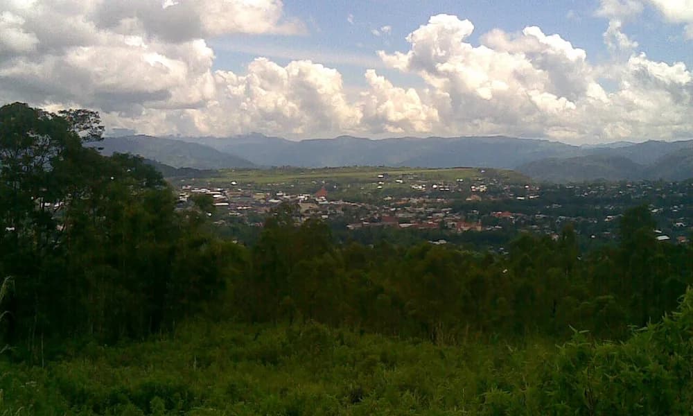
BMKG recorded more than 13,000 aftershocks by 5 September, the largest about M6.1. A few were deadly on their own: an aftershock on 17 August killed two people in Ngada. A long aftershock sequence is normal after a shallow M7.8 on land; it keeps people out of damaged homes and slows rebuilding.
About 13 hours after the Flores mainshock, a separate M6.9 struck under North Sumatra, near Pematangsiantar. That one was roughly 175–180 km deep, inside the subducting slab, and caused no significant damage. The two shocks were not linked. Together they make a neat depth lesson: a shallow M7.8 under inhabited land killed over a hundred people, while a deep M6.9 the same day barely made the news.
Tectonics: a thrust behind the arc
Indonesia sits where the Indo-Australian Plate moves north and sinks beneath the Sunda Plate (part of Eurasia). The front of that collision is the Sunda Trench, also called the Java Trench, south of Sumatra, Java, Bali and Nusa Tenggara. Above the sinking slab is a chain of volcanoes: the Sunda Arc, which continues east as the Banda Arc. Flores itself is a volcanic island on that arc. Kelimutu, Inierie and Lewotobi are Flores volcanoes.
So far this is the familiar subduction picture. The twist is east of Bali. Here the Australian continental margin has started to collide with the Banda Arc near Timor. Continental crust is too buoyant to sink easily, so part of the plate convergence cannot be taken up at the trench. Instead, the arc itself is being pushed north over the floor of the Flores Sea. The fault doing that work is the Flores Back Arc Thrust: an east-trending thrust that runs along the northern side of the islands from roughly Bali and Lombok eastwards past Flores, and dips south beneath them.
“Back-arc” simply means on the side of the volcanic arc away from the trench. A back-arc thrust is a compressional fault there. It is not a subduction megathrust; the plate interface is far to the south, under the Savu Sea and Timor. The Flores fault is a younger, shallower thrust breaking the overriding plate.
For UPSC, the cleanest way to hold this is a north–south cross-section of Flores:
- South: the Sunda / Java Trench and, further east, the Timor Trough — the plate boundary.
- Middle: the volcanic arc — Flores, with Kelimutu.
- North: the Flores Back Arc Thrust under the Flores Sea — where the 2026 quake broke.
The same fault system produced the 2018 Lombok earthquakes, which killed hundreds on Lombok. Flores 2026 is its eastern cousin.
Contrast this with the other 2026 Indonesian cards. The Pacitan earthquake of February 2026 was a modest thrust on the Sunda subduction interface off East Java — the trench side of the same arc. The North Maluku earthquake of April 2026 sat in the Molucca Sea, where the Philippine Sea, Pacific and Sunda plates meet in a tangle of small plates. Flores sits between the two, on the back side of the arc.
Why the 2026 tsunami was smaller than 1992
On 12 December 1992, an M7.8 earthquake struck the same northern Flores coast. It killed about 2,500 people, and a tsunami helped by a submarine landslide ran up as high as about 26 m in places. The town of Maumere and nearby islands such as Babi were devastated.
The 2026 earthquake was the same size and on the same fault system. It ruptured an adjacent segment. Yet the tsunami peaked at 1.61 m. The main reason is where the slip happened. A tsunami needs a large, sudden vertical movement of the seafloor. In 2026, most of the slip occurred on the part of the fault that lies under land, beneath northern Flores, because the fault dips south under the island. Moving rock under hills does not move water. In 1992 much more of the uplift was offshore, and a submarine landslide added to the wave.
So the two Flores earthquakes give one sentence for an answer: same magnitude, same fault, different tsunami — because the location of slip relative to the shoreline matters more than the magnitude number.
| Feature | 1992 Flores | 2026 Flores |
|---|---|---|
| Date | 12 December 1992 | 15 August 2026 |
| Magnitude | M7.8 | M7.8 (USGS) |
| Fault | Flores Back Arc Thrust | Flores Back Arc Thrust (adjacent segment) |
| Where most slip was | Largely offshore | Largely under land |
| Tsunami | Destructive; run-up up to ~26 m | Maximum 1.61 m at Reok |
| Deaths | About 2,500 | 136 |
Why this matters for UPSC
Prelims. Expect a place-and-process question. The safe facts: Flores is in East Nusa Tenggara, in the Lesser Sunda Islands; the 2026 quake was a thrust on the Flores Back Arc Thrust; there was a local tsunami (1.61 m at Reok). Common traps: putting the quake on the Java Trench, calling it strike-slip, or swapping Flores Sea (north) with Savu Sea (south). Kelimutu, with its three coloured crater lakes, is a regular map-based item and was damaged in this quake.
GS-1 (geography). Use Flores to show that a subduction zone is not one fault. The trench, the arc and the back-arc each have their own earthquakes. Add the arc–continent collision near Timor as the reason the back-arc is in compression. One labelled sketch covers it.
GS-3 (disaster management). Three points carry an answer. First, warning speed: BMKG’s warning went out in just over two minutes, but for a near-shore source the first waves can arrive within minutes, so people must move on shaking, not wait for a siren. Second, housing: most deaths and nearly all of the 95,000-plus damaged homes reflect non-engineered buildings on hillsides. Third, recovery: 13,000-plus aftershocks kept 188,000 people out of their homes for weeks — shelter, sanitation and schooling are the long tail of the disaster.
India link. The Andaman and Nicobar Islands sit on the northern continuation of the same Sunda subduction system, which produced the 2004 Indian Ocean tsunami. Barren Island is India’s arc volcano on that margin. Flores shows what the back side of such an arc can do.
Current affairs stacking. Flores fits a 2026 Indonesia set on the Places in News timeline: Pacitan (trench thrust, February), North Maluku (Molucca Sea, April), Flores (back-arc thrust, August), and the Anak Krakatau eruption in the Sunda Strait in September.
Facts that are easy to mix up
M7.8 versus M7.7. USGS gives Mww 7.8; BMKG gives Mw 7.7. Use M7.8 and note that BMKG’s figure was slightly lower.
10 km versus 18 km depth. Both are “shallow”. USGS says about 10 km; BMKG about 18 km. Either way, the quake was in the upper crust.
Back-arc thrust versus megathrust. The Mindanao M7.8 of June 2026 was a megathrust on the Cotabato Trench. Flores, at the same magnitude, was not on a trench at all.
Flores Sea versus Savu Sea. The epicentre was in the Flores Sea, north of the island. The plate boundary is south, toward the Savu Sea and Timor.
Ende versus Reok. Ende was the reference town for the epicentre (USGS distance). Reok, in Manggarai, recorded the highest tsunami.
1992 versus 2026. Same island, same fault system, same magnitude. 1992 killed about 2,500 with a large tsunami; 2026 killed 136 with a tsunami of 1.61 m.
Flores versus North Sumatra. The deep M6.9 near Pematangsiantar on the same day was an unrelated intraslab quake about 175–180 km down. It did not cause damage and is not an aftershock of Flores.
Prelims snapshot
| Question type | Answer to lock |
|---|---|
| Date | 15 August 2026 |
| Magnitude | M7.8 (USGS); 7.7 (BMKG) |
| Country / province | Indonesia / East Nusa Tenggara |
| Island group | Lesser Sunda Islands (Nusa Tenggara) |
| Fault | Flores Back Arc Thrust |
| Type | Shallow thrust, behind the volcanic arc |
| Deaths | 136 (BNPB) |
| Tsunami | Maximum 1.61 m at Reok |
| Historic comparison | 1992 Flores M7.8, about 2,500 dead |
| Record | Indonesia’s deadliest quake since Cianjur, 2022 |
Frequently asked questions
What was the Flores earthquake of 2026?
It was a shallow M7.8 thrust earthquake off the north coast of Flores, East Nusa Tenggara, Indonesia, at 05:58 local time on 15 August 2026. It ruptured the Flores Back Arc Thrust, killed 136 people, injured 1,776, damaged about 95,567 homes and caused a local tsunami of up to 1.61 m at Reok.
What is the Flores Back Arc Thrust?
It is an east-trending thrust fault on the northern (back-arc) side of the Lesser Sunda Islands. It dips south beneath the islands. It exists because the Australian continental margin is colliding with the Banda Arc near Timor, so some of the plate convergence is pushed onto a fault behind the volcanic arc instead of the trench in front of it.
Was the 2026 Flores earthquake on the Java Trench?
No. The Java (Sunda) Trench lies far to the south. The 2026 rupture was on the back-arc thrust north of Flores. The Pacitan quake of February 2026 is the trench-side example on the same arc.
Why was the tsunami much smaller than in 1992?
Most of the 2026 slip happened under land, beneath northern Flores, so little seafloor was lifted. In 1992 more uplift was offshore and a submarine landslide added to the wave, giving run-ups of about 26 m. The 2026 maximum was 1.61 m at Reok.
Which districts were worst affected?
Manggarai (41 deaths) and East Manggarai (36) had the highest tolls, followed by Nagekeo (13). Deaths were also recorded in Sikka, Ende, Ngada and West Manggarai.
How does this compare with other 2026 Indonesian events?
Pacitan (February) was a smaller trench-side thrust off Java. North Maluku (April) was in the Molucca Sea plate tangle. The Anak Krakatau eruption (September) was a Sunda Arc volcano. Flores is the back-arc member of that set and the deadliest of them.
What should UPSC aspirants remember about the Flores earthquake?
15 August 2026; M7.8; off north Flores, East Nusa Tenggara; Flores Back Arc Thrust; 136 dead; tsunami 1.61 m at Reok; smaller than 1992 because slip was mostly under land; deadliest Indonesian quake since Cianjur 2022.