
An M6.7 earthquake struck beneath the Ayacucho region of Peru’s southern Andes on 20 August 2026, at 13:00 local time. It started about 99 km below the surface, inside the Nazca Plate as it sinks under South America. Shaking was felt across six regions and in the capital, Lima. Peru’s National Emergency Operations Centre (COEN) reported no deaths. Early counts listed at least two injured and damage to houses, health centres and a school in Ayacucho and Cusco. For UPSC, this is a clean intermediate-depth case: a strong quake felt over a wide area, but much less destructive than a shallow quake of the same size would have been.
Key highlights
- Date and time: 20 August 2026, 13:00 local (18:00 UTC).
- Magnitude: USGS Mww 6.7; Peru’s Instituto Geofísico del Perú (IGP) gave a higher local estimate of 7.2.
- Depth: About 99 km (USGS) — an intermediate-depth quake inside the subducting Nazca slab.
- Location: About 14.63° S, 73.64° W, Parinacochas area, Ayacucho; USGS reference point “35 km ENE of Tambo”.
- Impact: No deaths; at least 2 injured in early reports; 22 homes, 6 health centres and a school affected; about 6,000 power users cut off.
- Felt in: Ica, Arequipa, Huancavelica, Apurímac, Cusco and Lima.
- Exam hook: Depth decides damage. Same plate pair that built the Andes, different consequences at 99 km.
Where did the Ayacucho earthquake strike?
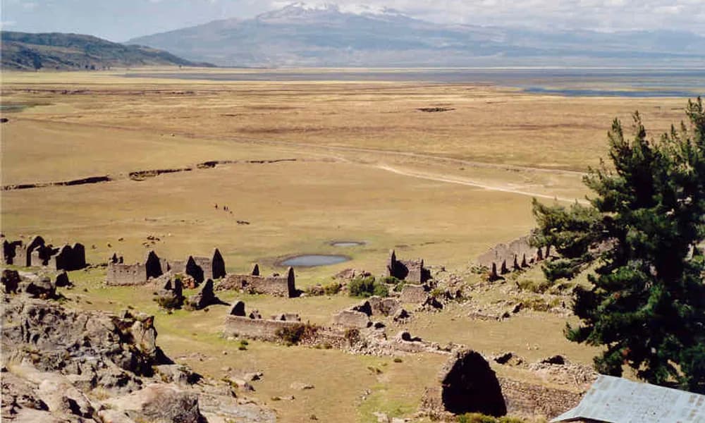
Ayacucho is a highland region in south-central Peru, between Lima and Cusco. Its southern part, including Parinacochas and Lucanas provinces, is high Andean plateau and valley country, with towns such as Coracora, Puquio and Upahuacho. The epicentre lay in this area, roughly 38 km north-west of Upahuacho. Lima is several hundred kilometres to the north-west, on the Pacific coast.
On a map, draw a line from the coast inland. Offshore lies the Peru–Chile Trench (also called the Atacama Trench). Near the coast at this latitude, the Nazca Ridge — a submarine mountain chain on the Nazca Plate — is being pushed under the continent. Inland come the coastal desert, then the high Andes, then the Amazon lowlands. The Ayacucho epicentre sits under the Andes, some distance inland from the trench. That is exactly where a subducting slab is expected to be about 100 km down.
| Fact | Detail |
|---|---|
| Date | 20 August 2026, 13:00 local (18:00 UTC) |
| Magnitude | Mww 6.7 (USGS); 7.2 (IGP) |
| Depth | About 99 km (USGS); IGP about 108 km |
| Epicentre | Parinacochas area, Ayacucho; ~35 km ENE of Tambo |
| Coordinates (approx.) | 14.63° S, 73.64° W |
| Plates | Nazca subducting beneath South American |
| Boundary / trench | Peru–Chile (Atacama) Trench |
| Type | Intermediate-depth, inside the slab |
| Deaths | None (COEN) |
| Injured | At least 2 in early reports |
| Felt | Ica, Arequipa, Huancavelica, Apurímac, Cusco, Lima |
The triple to lock is Ayacucho + Nazca under South America + ~99 km deep.
What happened on 20 August 2026
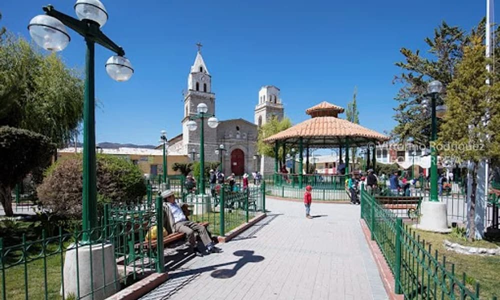
The shock came early on a Thursday afternoon. People in Coracora, the capital of Parinacochas province, ran into the streets. Two people were hurt while leaving their homes, according to the first official reports. Local authorities said residents evacuated quickly and gathered in open spaces.
Damage was patchy rather than widespread. Early official figures listed 22 homes, six health centres and one school affected across several districts in Ayacucho and Cusco, including Puquio, Pullo, Coracora, Upahuacho, San Pedro and Pichari. Some later preliminary tallies gave somewhat higher counts as inspections continued. About 6,000 electricity users lost power for a time. Regional schools were closed the next day so buildings could be checked. Adobe houses — common in the Andean highlands — and roads exposed to rockfall were the main concerns. No deaths were reported.
The quake was felt over a very wide area: Ica, Arequipa, Huancavelica, Apurímac and Cusco, and more weakly in Lima. USGS gave a green PAGER alert, meaning low expected fatalities and losses. No tsunami threat was issued; a quake this deep under land does not move the seafloor.
Tectonics: Nazca under South America
The west coast of South America is a textbook ocean–continent convergent boundary. The oceanic Nazca Plate moves east and sinks beneath the continental South American Plate along the Peru–Chile Trench. Convergence here is fast by global standards — several centimetres a year.
That one process explains three things a UPSC student needs:
- The Andes. Compression of the overriding continent has thickened and lifted the crust into the world’s longest continental mountain range. The Andes are the standard example of fold mountains formed at an ocean–continent boundary, as opposed to the Himalaya, which formed by continent–continent collision.
- The volcanoes. As the slab sinks to about 100 km and more, it releases water that lowers the melting point of the mantle above it. The melt rises to form a chain of stratovolcanoes. In southern Peru this is the Central Volcanic Zone: Sara Sara in Parinacochas itself, and further south Coropuna, Sabancaya, El Misti and Ubinas.
- The earthquakes. Peru has three kinds. Shallow megathrust quakes break the plate interface near the coast. Shallow crustal quakes break faults inside the Andes. Intermediate-depth quakes, like Ayacucho 2026, break inside the sinking slab itself.
A useful regional detail: the slab under central Peru is unusually flat. Instead of diving steeply, it slides almost horizontally for a long distance under the continent before bending down. The subduction of the buoyant Nazca Ridge is widely linked to this flat-slab segment, and the volcanic arc is largely missing above it. The Ayacucho epicentre lies near the southern edge of that zone, where the slab begins to dip more steeply and the volcanoes reappear.
Why depth mattered: shallow versus intermediate
Seismologists group earthquakes by focal depth:
| Class | Depth | Typical effect |
|---|---|---|
| Shallow | 0–70 km | Most destructive; can cause tsunamis if offshore |
| Intermediate | 70–300 km | Felt widely; damage usually more limited |
| Deep | 300–700 km | Rarely damaging at the surface |
At 99 km, the Ayacucho quake was firmly intermediate. Seismic energy spreads and weakens as it travels up through 100 km of rock. By the time it reaches the surface, it is spread over a much larger area but with lower peak intensity. That is why the quake was felt from Cusco to Lima but damaged only a limited number of buildings.
Peru’s own history shows the contrast. The 1970 Ancash earthquake (M7.9), a shallow offshore event, triggered the avalanche from Huascarán that buried the town of Yungay and killed tens of thousands. The 2007 Pisco earthquake (M8.0), a shallow megathrust, killed several hundred people in Ica. By contrast, the 2019 northern Peru earthquake (M8.0) was more than 100 km deep and, despite its size, caused relatively few deaths. Ayacucho 2026 belongs with 2019, not with 1970 or 2007.
The 2026 Places in News timeline already has other depth lessons. The Hindu Kush earthquake of April was also intermediate-depth and was felt in Delhi. The Tonga M7.5 was about 230 km deep. The Sabah M7.1 was deep-focus at about 629 km. Read together, they show that depth is often a better guide to damage than magnitude.
Two magnitudes, one earthquake: how Peru reports quakes
Within minutes of the shock, two numbers were circulating. The Instituto Geofísico del Perú (IGP), which runs the national seismic network, issued a bulletin giving magnitude 7.2 at a depth of about 108 km, north of Coracora. USGS published M6.7 at about 99 km. Both agencies were describing the same event.
The gap is common for first reports. National agencies often publish a fast local estimate from their own stations, while USGS uses a moment magnitude (here Mww) computed from long-period waves recorded around the world. Moment magnitude measures the physical size of the rupture — the area of the fault times the slip times the stiffness of the rock — and is the figure used for international comparison. For an exam answer, quote M6.7 (USGS) and, if relevant, note that IGP’s initial figure was higher.
Response worked through Peru’s civil-defence chain. IGP located the quake; the National Emergency Operations Centre (COEN) collected damage reports from regional and district offices; local authorities closed schools for inspection. The Chilean navy’s hydrographic service separately confirmed there was no tsunami threat to Chile’s coast — routine for any strong quake near the shared trench.
The bigger lesson is what did not happen. Peru’s coast, including Lima, sits above the shallow plate interface, where long-locked segments can produce great megathrust earthquakes and tsunamis. An intermediate-depth shock under the highlands is not a release of that stored strain. Ayacucho 2026 should be read as a reminder of the system, not as a sign that the coastal hazard has eased.
Why this matters for UPSC
Prelims. Expect plate-pair and landform questions. Nazca under South American; Peru–Chile (Atacama) Trench; Andes as ocean–continent fold mountains. Traps include swapping Nazca with the Cocos Plate (which subducts under Mexico and Central America, as in the Chiapas earthquake), or with the Caribbean Plate (the Venezuela earthquake boundary).
GS-1 (geography). Ayacucho is a ready-made example for three syllabus topics in one: plate convergence, mountain building and the distribution of earthquakes by depth. A Wadati–Benioff zone — the dipping band of earthquakes that traces a sinking slab — is the term to use. Under Peru, quakes get deeper as you move inland from the trench, which is exactly why a quake under the Andes is about 100 km deep.
GS-3 (disaster management). The case supports two points. First, a limited toll was not luck alone: depth did much of the work. Second, adobe housing in the Andes remains the main vulnerability; the same building stock would fare far worse in a shallow quake. India’s own Hindu Kush–Pamir shocks raise the same issue for Himalayan towns.
Map work. Know Peru’s neighbours (Ecuador, Colombia, Brazil, Bolivia, Chile), the Pacific coast, the Andes, and the source of the Amazon in the Peruvian Andes. Ayacucho lies between Lima and Cusco in the southern highlands.
This explainer sits with the Places in News timeline.
Facts that are easy to mix up
M6.7 versus M7.2. USGS reported Mww 6.7. Peru’s IGP gave 7.2 in its own bulletin. Use M6.7 for international comparison and mention the IGP figure if needed.
99 km versus 66 km. USGS’s first estimate put the depth near 66 km; the reviewed figure is about 99 km. IGP gave about 108 km. All three agree it was well below the crust.
Intermediate-depth versus megathrust. A megathrust breaks the plate interface near the trench. Ayacucho broke inside the slab, far inland and deep.
Nazca Plate versus Nazca Ridge. The plate is the whole oceanic slab. The ridge is a submarine mountain chain riding on it, entering the trench off southern Peru.
Nazca versus Cocos. Nazca subducts under South America. Cocos subducts under Mexico and Central America.
Ocean–continent versus continent–continent. The Andes are ocean–continent. The Himalaya are continent–continent. Both are fold mountains; the processes differ.
Felt in Lima versus damage in Lima. Lima felt light shaking. Damage was in the Ayacucho and Cusco highlands.
Prelims snapshot
| Question type | Answer to lock |
|---|---|
| Date | 20 August 2026 |
| Magnitude | M6.7 (USGS); 7.2 (IGP) |
| Country / region | Peru / Ayacucho |
| Depth | About 99 km — intermediate |
| Plates | Nazca beneath South American |
| Trench | Peru–Chile (Atacama) Trench |
| Mountain link | Andes — ocean–continent convergence |
| Deaths | None |
| Tsunami | None |
| Exam contrast | Shallow 1970 Ancash / 2007 Pisco versus deep 2019 northern Peru |
Frequently asked questions
What was the Peru Ayacucho earthquake of 2026?
It was an M6.7 earthquake on 20 August 2026 at 13:00 local time, centred about 99 km beneath the Parinacochas area of Ayacucho in Peru’s southern Andes. It occurred inside the sinking Nazca Plate. It was felt in six regions including Lima, injured at least two people in early reports, damaged some homes and public buildings, and caused no deaths.
Why did a strong earthquake cause so little damage?
Because it was deep. At about 99 km, the shaking had to travel through a great thickness of rock before reaching the surface, so it was spread over a large area but with lower intensity. A shallow quake of the same size under the same towns would have been far more damaging.
Which plates caused the Ayacucho earthquake?
The Nazca Plate subducting beneath the South American Plate along the Peru–Chile (Atacama) Trench. The quake broke within the Nazca slab, not on the plate interface.
How is this earthquake linked to the Andes?
The same Nazca–South American convergence has compressed and uplifted the western edge of South America to form the Andes, and the melting above the sinking slab feeds the Andean volcanoes, such as Sara Sara in Parinacochas. The earthquake is a symptom of the process that built the mountains.
What is an intermediate-depth earthquake?
An earthquake with a focus roughly 70–300 km deep. Such quakes usually happen inside a subducting slab. They are felt widely but are generally less destructive than shallow quakes. The Hindu Kush earthquake felt in north India is another 2026 example.
Was there a tsunami?
No. The quake was deep and under land. It did not move the seafloor, and no tsunami threat was issued.
What should UPSC aspirants remember about the Ayacucho earthquake?
20 August 2026; M6.7; Ayacucho, southern Peru; about 99 km deep; Nazca under South America; Peru–Chile Trench; Andes as ocean–continent fold mountains; felt in Lima; no deaths; depth explains the limited damage.